
Technology

How To Incorporate American Community Survey data from TIGER Files
A 'how to' reference for students to join American Community Survey (census long form data) with TIGER data for use in ArcGIS. Thanks to Allison Meezan from Foothill Community College Los Altos Hills, CA. 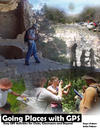
Going Places With GPS
Easy GPS Activities for Clubs, Classroom and Beyond is the first GPS book with fun and exciting lessons and activities that you can do with your GPS. This book eases the beginning user into using a GPS with straight forward, simple exercises and then gradually adds to the level of difficulty. This book is a must for any educator or club advisor who uses or wants to use GPS technologies in their courses. Families will thoroughly enjoy this book too! 
GPS Units by GIS Etc.
Our friends at GISEtc are world-class GIS educators who know the best units for teaching students about GPS technology. 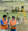
GPS Hardware Recommendations for K12
The Global Positioning System (GPS) is a navigation and precise-positioning tool. Developed by the Department of Defense in 1973, GPS was originally designed to assist soldiers and military vehicles, planes, and ships in accurately determining their locations world-wide. Today, the uses of GPS have extended to include both the commercial and scientific worlds. |
