
Center Information


Vincent A. DiNoto, Jr serves as the Principal Investigator and Director of the National GeoTech Center of Excellence located in Louisville, Kentucky. Mr. DiNoto handles the daily responsibilities of the National GeoTech Center.
Vincent A. DiNoto Jr.Director / Principal Investigator
|
Vincent A. DiNoto Jr., Director and Principal Investigator of the National Geospatial Center of Excellence, 502-213-7280, vince.dinoto@kctcs.edu
DiNoto, Vincent A. is Dean of College and Systemic Initiatives and Professor of Physics, Astronomy and Geosciences at Jefferson Community and Technical College located in Louisville, KY. He is Director and Principal Investigator of the National Geospatial Center of Excellence a National Science Foundation Center, located at Jefferson Community and Technical College. He received his M.A. and B.S. from Indiana State University and has been on the faculty at Indiana State University and Indiana University Southeast prior to coming to Jefferson. He is former co-PI of National Supply Chain Technology Education Center and the National Information and Computer Center and was director and co-PI of Kentucky Information Technology Center. He has served as PI, or co-PI on numerous NSF projects. He developed one of the first Astronomy Laboratories at a community college in the country. His current research interest include education technologies, contextual learning, integrated courses, mapping of historical Civil War Battlefields and Water Powered Industries. He has authored numerous courses and offered them in an online delivery mode. He has written and presented numerous professional article his most recent published work is on the Two Great Armories.
Click on his picture to watch the Welcoming video |
The Center's Staff is located at Jefferson Community and Technical College in Louisville, KY. The staff supports our partners with fiscal contract management, web development, video production, Geospatial mapping, travel and professional development, logistics, meeting and conference scheduling. The role of the staff is to allow the Co-PIs to focus on research and professional development for our clients. The Center is directed by Vincent A. DiNoto, Jr.; for additional information about the director please see his page.
Click on each picture to meet the members of our central team.
Click on each picture to meet the members of our central team.
Muhammad KattanGeospatial Technician & IT
|
Chris WrightGeospatial Technician & Remote Pilot
|
The Associate Directors are responsible for one of the Goals of the GeoTech Center as well as the Objectives and Activities of the goal. In addition the Associate Directors advise and assist the Director in the overall direction of the Center. Each of the Associate Directors are nationally recognized leaders in the field of geospatial technology.

Nicole ErnstAssociate Director / Co-Principal Investigator
|
Rodney JacksonAssociate Director / Co-Principal Investigator
|
Ann JohnsonAssociate Director / Co-Principal Investigator
|
Thomas MuellerAssociate Director / Co-Principal Investigator
|
Ken YanowAssociate Director / Co-Principal Investigator
|
The Assistant Directors work as either the lead or co-lead on activities of the GeoTech Center and are part of the overall team of the GeoTech Center. They assist the directors on emerging trends in geospatial information, science and technology.
Chris CruzAssistant Director / Senior Team
|
Candiya ManExternal Evaluator
|
Adam McKeeExternal Evaluator
|
The National Visiting Committee (NVC) is the official advisory board for the GeoTech Center. Led by a chairperson, the NVC serves as the eyes and ears for the program officer at the National Science Foundation (NSF) responsible for the Center’s primary funding. The NVC serves two roles: support and evaluative. In their support role, the NVC nurtures the Center in its operation by providing the Director and Principle Investigator with advice on the goals and direction of the Center. In their evaluative role, the NVC reviews the Center’s progress in meeting its annual goals, through consultation with the independent external evaluator. They formulate an annual report for the NSF Program Officer, who uses the information in their decision to renew funding for the Center.
Bill HodgeNational Visiting Council
|
Jonathan BeckNational Visiting Committee
|

Tim JohnsonNational Visiting Council
|
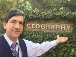
Joseph KerskiNational Visiting Council
|
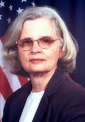
Roberta LenczowskiNational Visiting Committee
|
Jonathon LittleNational Visiting Committee
|

Andrew McKinneyNational Visiting Committee
|
Kevin MickeyNational Visiting Committee
|

Eric MuncyNational Visiting Committee
|
Diana RobinsonNational Visiting Committee
|
Demetrio ZourarakisNational Visiting Council
|
