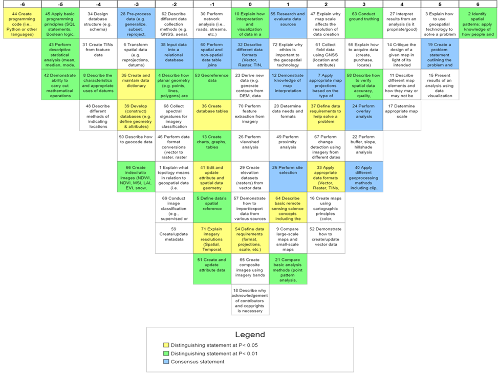
2020 Education Certification Cohort
Introduction
This research study uses Q Methodology to assess the perceptions of respondents towards the core competencies contained within the National Geospatial Technology Center of Excellence (GeoTech Center) Geospatial Competency Matrix.
Problem Statement
There has historically been a lack of external input from either secondary or post-secondary educators regarding their views towards geospatial competencies. What input there was did not force participants to discriminate between the relative importance of the competencies.
Purpose Statement
The purpose of the study is to explore the viewpoints of educational professionals toward the GeoTech Center Geospatial Competency Matrix and why they hold these views. By assessing the viewpoints of educators toward these competencies, the researcher can better understand how practitioners view core geospatial competencies.
Finding 1. This study revealed three viewpoints, which represent the different perspectives of educators participating in the research project. The three recognized factors characterize a substantial variation in the perceptions of technical geospatial competencies. The emerging factors were Factor 1: Digital Imagery is not Important, Factor 2: No Appreciation for Advanced Spatial Concepts, and Factor 3: Defining Data to Solve Problems.
Finding 2. The respondents shared some general impressions regarding the perceived relevance of the statements located within the GeoTech Center Geospatial Competency Matrix. Positively viewed competency areas included using geospatial science to solve problems, cartographic principles, and spatial analysis. Negatively viewed competency areas include mathematical operations, digital imagery, and computer programming.
Finding 3: The three factors shared eleven consensus statements, which appears reasonable given the limited number of factors. No apparent patterns emerged amongst the statements to indicate unanimity towards a competency area.
Conclusion
This study represented the results of an investigation to address how geospatial educators view the geospatial competency statements located within the GeoTech Center Geospatial Competency Matrix. The researcher collected data from 21 geospatial educators, with 19 respondents loading onto three factors. The study gathered demographic, Q-sort (quantitative), and narrative (qualitative) data. To address the Research Question (How do geospatial educators view the geospatial competency statements located within the GeoTech Center Geospatial Competency Matrix, and why?), the researcher performed factor analysis on the Q-sort submissions and generated three factors. The post-sort questionnaire provided additional information and critical insight to the researcher who used the qualitative data to build the narratives for each factor.
This research study used Q Methodological as a practical approach to examining the statements within a competency model. Moreover, it demonstrated a process using industry representatives to evaluate a conceptual model of competencies. The results of this study provided feedback from educators regarding how they perceive the competencies in the GeoTech Center Geospatial Competency Matrix. Better sources of data analysis, such as that found in this study, could enable educational institutions to more effectively engage industry partners and increase the value of their instruction to potential members of the geospatial workforce.


