GeoTech Center
  • HOME
  • NEWS AND EVENTS
  • RESEARCH STUDIES
  • EDUCATION
  • PROFESSIONAL DEVELOPMENT
  • CENTER INFORMATION
  • CONTACT US
  • Self Assessment Tool
  • New Geospatial Tools Self Assessment Tool

Professional Development

Discover free public data, tools, and resources from GeoTech Center
Picture

Upcoming Events


GeoEd'25 Conference, June 17 - 19, 2025


Picture

ADA - Section 508

​Esri Accessibility Conformance Report is a template used to document a product's conformance with accessibility standards and guidelines.

Picture

Books / Manuals​

Selected printed and virtual information from multiple sources

Picture

Certifications​

GeoTech Center and other organization certification programs


Picture

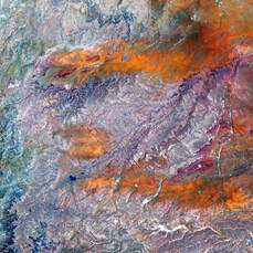
Earth Observation Day

The GeoTech Center provides a selection of Geospatial Websites
​Presented by the GeoTech Center

Picture

GeoEd Conference & Workshops

Presented by the National Geospatial Technology Center of Excellence Jefferson Community and Technical College at Southwest Campus

Picture

GIS Day

GeoTech Center GIS Day


Picture

Glossaries ​& Dictionaries​

Selected information to define terms and topics

Picture

Geospatial Websites​​

Selected websites from other organizations

Picture

Online Courses / Training Videos / Presentations​

Information that can assist in geospatial knowledge gain


Picture

Personal Assessment Tool

The GeoTech Center developed an assessment tool that is designed to provide educators with a method to assess the alignment to the skills and competencies industry users suggest that entry-level geospatial Technician/Technologist occupations should include.

Picture

Remote Sensing

Components from a workshop that was presented and tutorials 

Picture

Veterans' Resources

This section provides numerous resources for veterans (or current members of our armed forces) who are looking to attend a college or university. We begin with a general overview and then move to review servicemembers opportunity colleges (SOCs), the joint services transcript (JST), and a military crosswalk.


Picture

Arcade Lessons

A summary of lessons, about the use of Arcade scripting language in ArcGIS Pro, ArcGIS Map Viewer, and Dashboard along with an introduction.​

Picture

Workshops

GeoTech Center hosts workshops in the summer of each year. The workshops are open middle/high school educators and 2-year/4-year college faculty. Each of the workshops have a different focus in GIS field, so stay tuned for the new workshops.
Become a Member
Geospatial Resources
GeoTech Center's Presentations
Workshops
GTCM & Meta-DACUM Curriculum Guidelines
Map Library and Data
Veterans' Resources
Partners


Copyrighted ©2024  Jefferson Community and Technical College • 1000 Community College Dr. • Louisville, KY 40272 • (502) 213 - GEOT (4368) •JF-[email protected] 
​NSF: DUE 1304591, DUE 1644409
, DUE 1700496, DUE 1937177, DUE 1938717, DUE 1937237, and DUE 2202038
Opinions expressed are those of the authors and not necessarily those of the National Science Foundation. 
National Science Foundation