
Geospatial Websites
Discover free public data, tools, and resources from GeoTech Center
What is GIS?This is probably the most asked question posed to those in the Geographic Information Systems (GIS) field
|

What is GIS?A spatial system that creates, manages, analyzes, and maps all types of data
|
GIS FieldsWhich fields GIS can be used at?
|
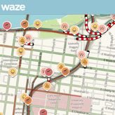
GIS ApplicationsGeographic Information Systems (GIS) can be used in various fields
|
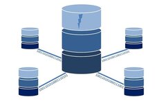
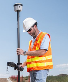
GIS Data ExplainedNow we understand what a GIS is and what is can do, the next step is to understand how a GIS is made. But first you need to take a crash course in GIS data
|
GIS Data - USGSUSGS is a primary source of GIS Data. Our data and information is presented both spatially and geographically
|
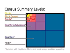
About Census Summary LevelsMore detailed descriptions for all of the summary levels for which the Census Bureau tabulates data
|

Census - Demographic DataCensus Bureau’s demographic data that can be linked to the TIGER/Line Files and Shapefiles' (GEOIDs)
|

Census - TIGER/Line FilesThe core TIGER/Line Files and Shapefiles do not include demographic data, but they do contain geographic entity codes (GEOIDs)
|

GIS Maps - USGSUSGS is a primary source of Geographic Information Systems (GIS) Maps
|
GIS HealthGIS and Public Health at CDC
|

Top 20 Resources - GIS in EducationJoseph Kerski, Ph.D. GISP
Geographer – Education Manager - Esri |
Open TopographyOpen Topography facilitates community access to high-resolution, Earth science-oriented, topography data, and related tools and resources.
|

USGS National Geospatial ProgramThe National Map is a collaborative effort among the USGS and other Federal, State, and local partners to improve and deliver topographic information for the Nation.
|

USGS National Water Informationprovide access to water-resources data collected at approximately 1.9 million sites in all 50 States
|
