
Concept Modules and Demonstration Videos
Discover free public data, tools, and resources from GeoTech Center
Concept Modules
The concept modules cover a single topic and are meant to provide elementary understanding for functional literacy.
|
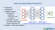
Artificial Intelligence, Machine Learning, Deep Learning, and Internet of Things - By: Ann Johnson
|
|
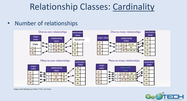
Attribute Relationship - By: Wing Cheung
|
|
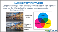
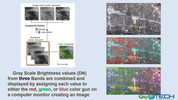
Color - By: Ann Johnson
|
|
Data Management - By: Ann Johnson
|
|
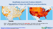
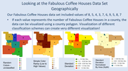
Data Visualization and MAUP - By: Ann Johnson
|
|
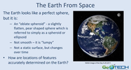
Datum - By: Ann Johnson
|

|
Ethics - By: Ann Johnson
|
|
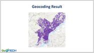
Geocoding - By: Thomas Mueller
|

|
|
|
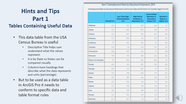
Hints and Tips for Preparing Excel and CSV Data Tables for Use in ArcGIS Pro, Part II - By: Ann Johnson
|
|
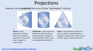
Map Projections - By: Ann Johnson
|

|
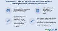
Mathematical and Geospatial Technology, Part I - By: Ann Johnson
|
|
Mathematical and Geospatial Technology, Part II - By: Ann Johnson
|
|
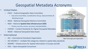
Metadata - By: Ann Johnson
|
|
Programming in Geospatial Technology, Part I - By: Vincent A. DiNoto, Jr.
|

|
Programming in Geospatial Technology, Part II - By: Vincent A. DiNoto, Jr.
|
|
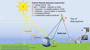
Remote Sensing - By: Ann Johnson
|
|
Remote Sensing Imagery Resolution - By: Ann Johnson
|
|
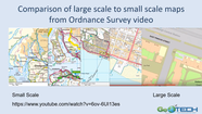
Scale - By: Ann Johnson
|
|
Statistics - Basic Topics, Part I - By: Ann Johnson
|

|
Statistics - Basic Topics, Part II - By: Ann Johnson
|
|
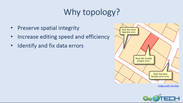
Topology - By: Wing Cheung
|
|
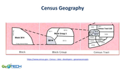
US Census History and Geography - By: Thomas Mueller
|
Demonstration Videos
|
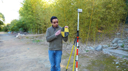
These short demonstration videos are designed to show students and educators how to perform a particular task in a step-by-step manner. The topics covered by the demonstration videos include managing geospatial data in ArcGIS Pro, collecting field data using real-time kinematic GPS, and implementing high accuracy workflows in drone data processing. To suggest topics for future demonstration videos, please contact the GeoTech Center team.
|
|
Why Ground Control Points? - Episode 1
|

|
Equipment Setup and Data Collection - Episode 2
|

|
Incorporating GCPs in your Workflow - Episode 3
|

|
Basic Database Management with Python
|

|
Building Relationship Classes
|

|
Designing and Populating a Geodatabase
|

|
Geodatabase Management and Optimization Strategies
|
|
How to Create ArcGIS StoryMap Collections
|
|
Introduction to Arcade Expressions
|
|
Introduction to ArcGIS QuickCapture
|
|
Working with CAD Data in ArcGIS Pro
|
|
Working with Feature Class Attachments
|
|
Working with LiDAR Data in ArcGIS Pro
|

|
Working with the New Census Data Platform: An Introduction to Data.census.gov
|
