GeoTech Center
  • HOME
  • EVENTS AND NEWS
    • GeoEd '20 >
      • GeoEd Conference Archives
    • Regional Workshops 2019
    • Virtual Workshops 2020
    • Geospatial Education Awards
    • Geospatial Technology Skills Competition Winner
    • GIS Articles
    • Newsletters
    • Other Events >
      • ATE Central Events
      • SCATE - Teaching Technicans Events
    • Webinars Series >
      • Webinar Archives
  • RESEARCH STUDIES
    • GTCM
    • Q Methodology
  • EDUCATION
    • Concept Modules and Demonstration Videos​
    • DACUM Results >
      • DACUM Research Chart for Geospatial Intelligence Specialist
      • DACUM Research Chart for Unmanned Aircraft Systems Operations Technician
      • GTCM Meta-DACUM
    • Developing a GTCM Modeled Geospatial Program
    • Geospatial Mentors
    • GeoTech Center National Program Locator
    • GeoTech Center's Presentations >
      • ATE PI 2019
    • Map Library and Data Resources
    • Model Courses
    • Supporting Your Program
    • Syllabi Repository >
      • Upload Syllabi Repository
    • Virtual GIS Day 2020 - Session Recordings
    • Virtual Office Hours
  • PROFESSIONAL DEVELOPMENT
    • ADA (Section 508)
    • Geotech Center Remote Sensing Workshop
    • Geospatial Websites
    • Personal Assessment Tool
    • Veterans' Resources >
      • Institutions of Higher Education >
        • Military Friendly Colleges
        • Servicemembers Opportunity Colleges >
          • Principles
          • Institutional Membership
          • Conditions for Membership
          • Criteria
          • Institutional Operating Guidelines
          • Standards of Good Practice
          • Principles for Higher Education Institutions
        • Voluntary Education Program
      • Joint Services Transcript
      • Military Crosswalk of Competencies
      • Military to Civilian Occupation Translator
      • Useful Web Links for Veterans and Service Members
  • CENTER INFORMATION
    • Central Office
    • Director
    • Associate Directors /Co-Principal Investigator
    • Assistant Director / Senior Team
    • National Visiting Committee
    • Center Partners
    • Professional Organizations
    • Become a Member
  • CONTACT US

Education Partners

The GeoTech Center is proud to partner with the following colleges and organizations to promote geospatial technology education at all levels: secondary, college, and university.
Picture
Virginia Community College Geospatial Portal
The VCCS Geospatial Portal serves as a gateway of information for VCCS faculty, students, and others interested in supporting the development of a geospatially literate workforce in Virginia.
Picture
Teach Spatial
Our goal is to aid in the development of explicit spatial learning objectives from a multi- or cross-disciplinary perspective.
Picture
Fidelis Education
The latest military to civilian transition website.  Fidelis seeks to improve the pipeline of veteran students into the higher education pipeline.
Picture
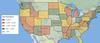
National Map of US Geospatial Programs
Map of US Geospatial academic programs at two year colleges and four year universities
Become a Member
Geospatial Resources
GeoTech Center's Presentations
Regional Workshops
GTCM & Meta-DACUM Curriculum Guidelines
Map Library and Data
Veterans' Resources
Partners


Copyrighted ©2020  Jefferson Community and Technical College • 1000 Community College Dr. • Louisville, KY 40272 • (502) 213 - GEOT (4368) •JF-GeoTech@kctcs.edu 
​NSF: DUE 1304591, DUE 1644409
, DUE 1700496, DUE 1937177, DUE 1938717, and DUE 1937237
Opinions expressed are those of the authors and not necessarily those of the National Science Foundation. 
National Science Foundation