GeoTech Center
  • HOME
  • NEWS AND EVENTS
    • Excellence in Geospatial Education Awards
  • RESEARCH STUDIES
  • EDUCATION
  • PROFESSIONAL DEVELOPMENT
  • CENTER INFORMATION
  • CONTACT US
  • New Geospatial Tools Self Assessment Tool

General Map Information

Discover free public data, tools, and resources from GeoTech Center
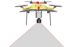
Picture


Picture

Drone Mapper
​


Picture

GeoTech Center
​


Picture

iGETT
Integrated Geospatial Education and Technology Training 


Picture

KAMP
​Kentucky Association of Mapping Professionals


Picture

Landsat Explorer
​


Picture

NOAA ​National Weather Service
​


Picture

NOAA GPS
​


Picture

Open Topography
​


Picture

Unlock Earth’s Secrets​


Picture

U.S. Census American FactFinder​


Picture

USDA​ National Geospatial Center of Excellence​


Picture

USGS Geospatial Data Sources​

Become a Member
Geospatial Resources
GeoTech Center's Presentations
Workshops
GTCM & Meta-DACUM Curriculum Guidelines
Map Library and Data
Veterans' Resources
Partners


Copyrighted ©2024  Jefferson Community and Technical College • 1000 Community College Dr. • Louisville, KY 40272 • (502) 213 - GEOT (4368) •JF-[email protected] 
​NSF: DUE 1304591, DUE 1644409
, DUE 1700496, DUE 1937177, DUE 1938717, DUE 1937237, DUE 2202038, and DUE 2500731
Opinions expressed are those of the authors and not necessarily those of the National Science Foundation. 
National Science Foundation