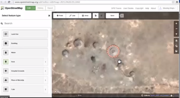
Humanitarian Mapping
This program will utilize Open Street Map to map features
|
Presented by: Thomas R. Mueller, Ph.D., GISP, and Advisor: Geography Major with GIS and Emergency Management Concentration, Co-Director: Pennsylvania View, Department of Earth Sciences, California University of Pennsylvania.
|
|
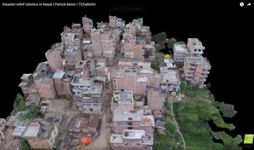
Disaster-Relief Robotics in Nepal | Patrick Meier | TEDxBerlinDr. Patrick Meier is an internationally recognized expert on Humanitarian Technology. In 2015, he spearheaded the Bank’s post-disaster UAV mission in response to a Category 5 Cyclone in the Pacific. He was subsequently invited by the UN to coordinate UAV teams responding to the Nepal Earthquakes. He later conducted a joint disaster recovery UAV Mission in Nepal to support rebuilding and preparedness efforts.Patrick is the Executive Director of WeRobotics and the founder of the Humanitarian UAV Network (UAViators).
|
|
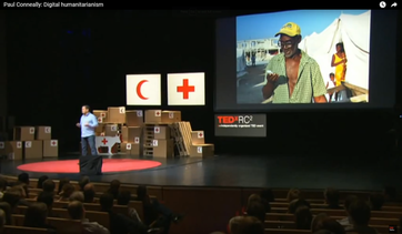
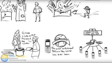
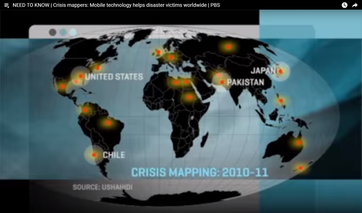
Digital Humanitarianism | Paul Conneally | TEDxRC2The disastrous earthquake in Haiti taught humanitarian groups an unexpected lesson: the power of mobile devices to coordinate, inform, and guide relief efforts. At TEDxRC2, Paul Conneally shows extraordinary examples of social media and other new technologies becoming central to humanitarian aid.
|
|
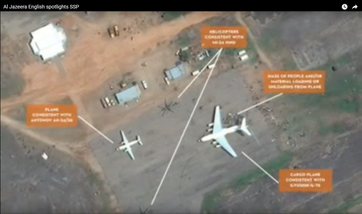
Satellite Sentinel Project's Innovative Approach to Conflict Monitoring | Al Jazeera EnglishIn an in-depth report, Al Jazeera English highlighted the Satellite Sentinel Project's unprecedented imagery of on-the-ground developments in the Nuba Mountains region of Sudan.
To learn more about the Satellite Sentinel Project's innovative approach to conflict monitoring, visit www.SatSentinel.org. |