Louisville Cohort Workshop Participants
This pages contains a list of our faculty participants for the very first GTCM Development workshop held in Louisville KY in June 2011.
 Wing Cheung
Briefly describe your current faculty position and your typical teaching responsibilities.
I am currently the coordinator of the GIS Certificate and Associate's degree program at Palomar College. I usually teach the introductory GIS course, an intermediate geodatabase management course, and an introductory remote sensing course. Aside from teaching, I am also responsible for updating the curriculum, and ensuring that all 9 courses in our GIS Certificate and Associate's degree program are reflective of industry needs and include the skills identified in the GTCM. In addition, my faculty position also requires me to host various GIS outreach events targeted at college and high school student.
Briefly describe your expertise and experience in GIS and/or remote sensing.
I have been in my current teaching position at Palomar College for nearly 4 years. Prior to my current tenure at Palomar College, I have worked as a Visiting Scientist at the United Nations Environment Programme, where I used GIS and Satellite data to analyze rainfall patterns. While in graduate school, I was a Teaching Assistant in a graduate level remote sensing course. I have also worked as a GIS intern at an environmental consulting firm, and a research assistant at a GIS education firm during my undergraduate years.
Briefly describe your experience in teaching GIS or remote sensing.
I have been teaching GIS and remote sensing for nearly 4 years at Palomar College. In my introductory GIS course, and my geodatabase management courses, I have written many of my own lab exercises using data downloaded from local government agencies. Topics covered in those labs include georeferencing, queries, versioning, arcpad, and others. Both courses are traditional face to face courses, and both are semester length courses.
Why do you want to participate in this workshop, and what might you be able to contribute to other participants?
I wish to participate in this workshop because I plan on updating my curriculum given the many new development in the GIS education field (i.e. introduction of the GTCM, ArcGIS 10) . I hope that my participation in the workshop will help align my existing curriculum or develop new curriculum that can be use to enhance student learning in GIS.
Given my previous experience in teaching GIS, developing new GIS courses and program (I created 4 new courses, and the GIS Associate's Degree program at Palomar College), and writing lab exercises, I will like to share my experience or assist other educators that are looking to start similar courses or programs at their institutions.
 Arlene Guest
Briefly describe your current faculty position and your typical teaching responsibilities.
I am an adjunct professor at Monterey Peninsula College (community college), where I teach the introductory GIS course which is the only GIS course there every spring semester. This is my 4th year (2008 - 2011).
I am also a Senior Lecturer at the Naval Postgraduate School, where I have been teaching a similar introductory GIS course for several years. I also taught GIS as an online course for several years, from 2004 - 2007. I also do some oceanographic research and teach an online oceanography course.
Briefly describe your expertise and experience in GIS and/or remote sensing.
Mostly my expertise and experience comes from teaching GIS and solving problems as the students take on their individual projects. I have also done some small projects that have related to research such as working with ship AIS (automated Identification Sytem) tracks, gathering and preparing GIS data for oceanographic experiments and exercises, and a study involving finding locations around the world with analogous environments.
Briefly describe your experience in teaching GIS or remote sensing.
I have been teaching GIS since 2004, both online and in the classroom, and in both a quarter and semester system, as described above. I have also taught a short course to the Coast Guard which was 4 days in length, and done several workshops that were just 3 days and shorter.
In all of my classes, I stress a problem-based hands-on approach. The students do problems of increasing complexity, culminating in an independent project.
Why do you want to participate in this workshop, and what might you be able to contribute to other participants?
I would like to know how others structure their courses and what topics they cover. For the colleges that have an entire program or certificate rather than a single course, how did they grow their program and make it sustainable? I am also specifically interested in those who teach GIS as a distance learning course because I am going to be re-developing a distance learning course in the next year for the Naval Postgraduate School, and possibly a hybrid course for the community college. What works in the DL environment and how do they manage the hands-on portion without having students get frustrated and discouraged?
In terms of contributions, I will be happy to share my class materials and assignments. I have taught enough students that I know what topics students have a harder time with. I also try to keep an open mind and listen to what others have to say.
 Margaret Chernosky
Briefly describe your current faculty position and your typical teaching responsibilities.
I teach Advanced Placement Human Geography (10 years) and GIS in Geography (3 years) at Bangor High School.
Briefly describe your expertise and experience in GIS and/or remote sensing.
I am comfortable using and teaching MyWorld GIS, and am migrating to ArcGIS 10 from ArcGIS 9.3. I am adept at getting raw data downloads, collecting and importing GPS data. I have taken courses and many workshops over a 10 year period, starting with ArcView 3.3. My strength is project design for the classroom.
Briefly describe your experience in teaching GIS or remote sensing.
Geographic Inquiry is my goal; therefore I use GIS and GPS as the tools to enhance spatial understanding. I have been teaching GIS in Geography for 3 years and longer as smaller units in traditional geography class. My students have consistently won awards in the Maine GIS Championships held in the spring.
ArcNews magazine recently published a story about my students. http://www.esri.com/news/arcnews/winter1011articles/maine-high-school.html
Why do you want to participate in this workshop, and what might you be able to contribute to other participants?
Extending my own geospatial knowledge and GIS skills is a continuing interest for me. I always return from a workshop with new directions.
For my contribution, I use GIS and methods of geographic inquiry to study issues of local concern with community partners. Many of these project designs can be translated to other towns/cities. With the support of our Dept of Transportation and our local police dept, we have studied teen driving accidents and crimes to motor vehicles in Bangor. I am most willing to share what we have done with suggestions and pitfalls. I also wish to be a part of an ongoing GIS educational community.
 Elizabeth Sedgwick
Briefly describe your current faculty position and your typical teaching responsibilities.
At Fond du Lac Tribal and Community College I currently serve as the Geospatial Technologies Program Coordinator in addition to teaching 12-15 credits per semester in geography and geospatial technologies. I am a fully online instructor and have moved curriculum into the Desire2Learn online learning platform utilized by the college.
Briefly describe your expertise and experience in GIS and/or remote sensing.
My graduate studies focused on mapping and analyzing indoor radon concentrations in Southern Minnesota. I was part of a NASA-AIHEC Summer Research Experience where I accompanied three students to the National Space Science and Technology Center in Huntsville, Alabama to begin a project utilizing remote sensing. Additionally, I was part of Cohort 2 of the Integrated Geospatial Education & Technology Training project, which introduced remote sensing fundamentals and applications into two-year college curriculum.
Briefly describe your experience in teaching GIS or remote sensing.
The courses that I have taught in GIS and Remote Sensing include:
Introduction to GIS
Data Acquisitions in GIS
Computer Cartography
Introduction to GPS
Introduction to Remote Sensing
Practical Applications in GIS
Visualizations in GIS
Additionally, I have worked with a faculty member in Environmental Science to develop interdisciplinary labs that I instructed for an environmental science course. We have since moved this to involve students as teaching assistants as I am now fully online.
Why do you want to participate in this workshop, and what might you be able to contribute to other participants?
I would like to become more familiar and involved with the GTCM Model and apply it to our curriculum at FDLTCC. I believe that I have an instructional perspective from both the Native American community and rural regions to contribute. Also, as a fully online instructor, I have an additional perspective to share.
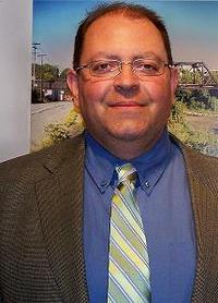 Mark Guizlo
Briefly describe your current faculty position and your typical teaching responsibilities.
I am lead faculty in Geography at Lakeland Community College (Ohio). Teaching responsibilities include survey level courses (Introduction to Geography and World Regional Geography), and courses in geospatial technology (Map Interpretation and Analysis, Geographic Information Science). I am also responsible for curriculum development and management of 7 part time faculty. We are proposing a degree and certificate program in Geospatial Technology, to start in phases, beginning in Fall 2011.
Briefly describe your expertise and experience in GIS and/or remote sensing.
PhD Research: I am using GIS and remote sensing in my dissertation at Kent State University, where I am a part time PhD student (my proposal for a dissertation on spatial interpolation in site selection analysis for viticulture is out for review by my committee at present and I expect to start research this Fall). I have recently taken courses in advanced remote sensing and advanced GIS, and I am currently completing independent research on spatial interpolation and modeling in ArcGIS, in connection with dissertation pilot research.
Lakeland Community College: I coordinate a new industry-user geospatial technology advisory committee at Lakeland Community College, I am coordinating a needs assessment survey that will asses industry needs in Northeast Ohio for a two-year program in Geospatial Technology, and have developed the proposed curriculum based on the US Dept. of Labor Geospatial Competency Workforce Model, other competency models, and input from regional GIS users.
Briefly describe your experience in teaching GIS or remote sensing.
I currently teach Map Interpretation and Analysis and Geographic Information Science, which are new courses that were added to our curriculum in 2010. Future proposed courses include spatial data acquisition and management, remote sensing, GIS applications, project management, and an internship/seminar course. Our department has requested an additional full time faculty position, which is being considered starting 2012. For now, I expect to coordinate new part time faculty (GIS professionals) in order to offer the curriculum, if approved, and will teach some of the new courses, depending on staffing needs.
Why do you want to participate in this workshop, and what might you be able to contribute to other participants?
The competency model has been useful in our curriculum development process, but I would benefit from being part of the workshop as the model becomes more "operational" for GIS educators. Networking opportunities are also important, as we are developing a strategic plan for geospatial technology at the college.
I will contribute based on work with GIS users in our region, our own experience with curriculum development, and my experience with spatial modeling and related research. Our proposed degree program offers a great opportunity to develop and test new curriculum in the Fall, when I will be teaching at least one course in the program.
 Chris Wayne
Briefly describe your current faculty position and your typical teaching responsibilities.
My teaching responsibilities are never typical. Although I am adjunct faculty at the Oregon Institute of Technology (OIT), I also teach to elementary school students, community college students at Klamath Community College (KCC), and professionals from Federal, Tribal, State and Local agencies. My primary job is GIS Analyst at Crater Lake National Park, but I am deeply involved in our educational endeavors with GIS, GPS and Interpretation.
I teach 10 - 15 GPS, GIS and general Geography courses or sessions per year for the audiences above. I have conducted GIS Day programs every year since 2007 for local schools which have a significant or majority Native American component, as well as a high majority of rural, low-income students. I am an instructor at the Classroom at Crater Lake Program, which hosts over 500 students per year from very diverse school districts.
I am currently mentoring students from OIT and Central Oregon Community College , and have mentored graduate and undergraduate students from Oregon State U. (OSU) and Southern Oregon University (SOU).
Briefly describe your expertise and experience in GIS and/or remote sensing.
I have been a GIS Analyst since 1997. During this time I have worked in Higher Education, the private sector, and government agencies at the Federal, State, Local and Regional level. In most of these positions I have been a "one person shop," which means that I work on everything from mapping water valves to assessing recreational opportunties for people with disabilties to analyzing impacts of fire on endangered species. This work involves the full range of Geographic Technologies: spatial analysis, image interpretation, data management, GPS data collection with both recreational and mapping-grade units (Garmin and Trimble, respectively) and personal interaction.
Briefly describe your experience in teaching GIS or remote sensing.
Since 1997 I have taught and developed formal classes for OSU, ESRI, the U. of Washington (UW), OIT, the US Fish and Wildlife Service, the US Forest Service and the National Park Service. I have taught informal classes for (and given demonstrations to) all of the above as well as KCC, SOU, Crater Lake Ski Patrol, the National Center on Accessibility, GIS users groups and conferences, numerous tribes and governments, non-profits and local schools.
Why do you want to participate in this workshop, and what might you be able to contribute to other participants? I live and work in a vast rural area with a natural resource based economy and many competing priorities regarding management of these resources. I have no plans to leave. We have many educational institutions that like most are struggling. I am fortunate that I have supervisory approval to pursue educational outreach activities that only a National Park can provide. My colleagues and I are deeply involved with education and research at nearly every educational institution in our area, including OSU., the U. of Oregon, SOU, OIT, KCC, Rogue Community College, local elementary schools, and numerous non-profits including outdoor schools, The Nature Conservancy, and land trusts.
To the other participants I can offer my experiences in working with diverse groups, my teaching experience and my extensive network of contacts in the Geography world, as well as my technical expertise in GIS and Remote Sensing and the nuances of working with different agencies.
My rules to live by when teaching: listen, plan ahead, learn, and participate! I am an good learner in that I pay attention and don't interrupt, (though I do like to move around a lot), and from colleagues I hear that I am good facilitator in large and small groups. I also feel that I am a very good writer and presenter, and I am always willing to offer CONSTRUCTIVE feedback on the work of others.
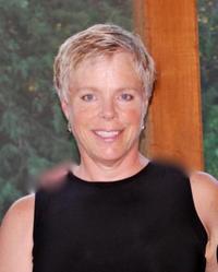 Margaret Porter
Briefly describe your current faculty position and your typical teaching responsibilities.
I teach the Intro and Advanced GIT courses at SIPI as well as Introductory Cartography and GIS Applications. I am responsible for organizing all other courses taught at SIPI, finding instructors, and any purchases made for the lab in pursuit of teaching GIT. I am also responsible for managing the Rural Geospatial Innovations (RGIS) Grant to SIPI that funds the GIT program.
Briefly describe your expertise and experience in GIS and/or remote sensing.
I have worked with GIS applications in Surveying, Systems Administration and Ground Water Modeling and support of Ground water investigations at the Office of the State Engineer for 17 years. I trained at Fresno State in a month long class on Photogrammetry. I am licensed Surveyor in New Mexico since 1990 and have a BS in Geographic Information Systems.
Briefly describe your experience in teaching GIS or remote sensing.
I have taught Introduction to Cartography for University of NM, continuing education 2 years, and have taught GIT courses at Southwest Indian Polytechnic Institute for the past 4 years.
Why do you want to participate in this workshop, and what might you be able to contribute to other participants?
I hope that my experience with the challenges of teaching GIS in Native America can be of some use to others, but I am really excited about what I may be able to gain in a workshop with other Instructors of GIS.
 Tom Mueller
Briefly describe your current faculty position and your typical teaching responsibilities.
I have been a GIS professor in the Department of Earth Sciences at California University of Pennsylvania for 12 years. I have taught a plethora of courses including GIS, Demographic Analysis, Emergency Management and World Regional Geography.
Briefly describe your expertise and experience in GIS and/or remote sensing.
As stated above, I have taught GIS for 12 years. I have also taught courses in Crime Mapping, Environmental Applications for GIS, and Disaster Vulnerability (Hazards and GIS). I currently serve as President of the Pennsylvania State System of Higher Education GIS Consortium, Chair of the Pennsylvania Hydrography Committee, Vice President of the Eastern Great Lakes ASPRS and Co – Chair of the Education Committee for GITA. When I first began as a professor, I had a very basic level of remote sensing. However I have attempted to increase that knowledge through readings and workshops. In fact a couple of years ago, I started taking graduate level remote sensing courses at Northeastern University. I am also the co – director of Pennsylvania View. Finally I am a GISP and work on their core competencies committee.
Briefly describe your experience in teaching GIS or remote sensing.
I have always tried to incorporate GIS and remote sensing into all my courses. For example, in the Demographic Analysis course, I had students use GIS and Census data to examine the historical population history of Pennsylvania. In the GIS focused classes, I always try and strike a balance between understanding the fundamentals of GIS and the software issues of GIS. Students are told in my classes that I am not there to teach them just how to use ArcGIS as this will keep them in cubicles for their career, my job is to teach them how to think spatially and discuss intelligently about geo-spatial technology (so they can be managers of those in the cubicles). Finally, in all my junior and senior level classes, the students are assigned a real world project. For example in Environmental Applications of GIS, the students are working with the Pittsburgh Parks Conservancy on a particular GIS database.
Why do you want to participate in this workshop, and what might you be able to contribute to other participants?
This is very Pollyana, but when my career is over I want people to say that I was able to push the geospatial technology discipline forward one step. This project is important to our discipline and I believe that I can bring my passion of GIS to help complete it.
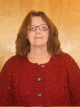 Karen Blevins
Briefly describe your current faculty position and your typical teaching responsibilities.
Residential Faculty / Geospatial Program Director. Responsible for teaching physical geography and all geospatial-related coursework. Responsible for all aspects (curriculum, course scheduling, adjunct) of the geospatial program.
Briefly describe your expertise and experience in GIS and/or remote sensing.
I have an advanced degree in the field as well as experience as a GIS Analyst. I have taken additional advanced coursework in GIS and remote sensing as well as have been a participant on IGETT (Cohort 2).
Briefly describe your experience in teaching GIS or remote sensing.
I develop and teach introductory, intermediate, and advanced coursework in GIS and remote sensing.
Why do you want to participate in this workshop, and what might you be able to contribute to other participants?
I want to become more familiar with the GCTM and how it may be applied to curriculum.
 Marc Zamkotowicz
Briefly describe your current faculty position and your typical teaching responsibilities.
I am currently an instructor with Burlington County College, a prominent community college in southern New Jersey. My standard course load includes at least three sections of earth science and at least one section of geography. The students in my classes are both traditional and non-traditional, non-science majors. Additionally, I teach at least one class within the Geospatial Technology program each semester. The students in these courses are predominantly non-traditional pursuing a degree or certificate in Geospatial Technology.
Briefly describe your expertise and experience in GIS and/or remote sensing.
My experience in GIS and remote sensing began when I was working as an environmental consultant in the late 1990's. I took two classes offered by ESRI on the use of their ArcView software. Unfortunately, I left the company before I could effectively incorporate this software into their operations. In January of 2002, I was hired by Burlington County College to teach their introductory earth science classes and begin the development of their Geospatial Technology program. The program was developed with partial funding from the National Science Foundation.
Briefly describe your experience in teaching GIS or remote sensing.
The Geospatial Technology program at Burlington County College is structured around four primary courses: Fundamentals of GIS, Advanced GIS, Fundamentals of GPS, and Remote Sensing. The first course offered, the Fundamentals of GIS class, has been taught since 2002, with the other courses following shortly after. I structured the courses in such a way that the students are exposed to the conceptual knowledge of these technologies through presentations provided at the beginning of the class. The latter part of the class is set aside to give the students an opportunity to work with the hardware and software through a series of hands-on laboratory exercises. I have been intimately involved with the development and instruction of these courses since 2002.
Why do you want to participate in this workshop, and what might you be able to contribute to other participants?
I have almost 10 years of experience in the development, implementation, and instruction of a variety of courses within the field of geospatial technology. I have been involved in the establishment of the curriculum, the acquisition of resources, troubleshooting problems, marketing, and many other facets of running a successful GIS program. I believe my experience could be beneficial to institutions looking to start a GIS program and I want to be able to assist others with the development of their programs.
_
 Sean Moran
Briefly describe your current faculty position and your typical teaching responsibilities.
GIS Department Chair for Austin Community College. Teach two to three courses a semester along with sponsoring two to three student GIS Capstone projects.
Briefly describe your expertise and experience in GIS and/or remote sensing.
15+ years experience as a GIS analyst, coordinator, and manager; including positions with the Houston Downtown Management District, Travis County, Texas Natual Resources Information Service, and URS Coporation. Served as Regional Planning Director for the Capital Area Council of Governments (CAPCOG) in the last five years before joining Austin Community College as the GIS Department Chair and full-time faculty member.
Briefly describe your experience in teaching GIS or remote sensing.
Since 2005, served as a part-time GIS adjunct faculty member at the University of Texas and Austin Community College. Joined Austin Community College as a full-time faculty member in June of 2010. Experience in teaching Introduction to GIS, GIS II, Data Acquisition and Analysis in GIS, GIS & GPS, and the GIS Capstone.
Why do you want to participate in this workshop, and what might you be able to contribute to other participants?
Synergizing our efforts will not only improve our individual programs, but will contribute toward a cohesive and visible national effort that will make our graduates more competitive in the GIS profession.
 Albert Lewandowski
Briefly describe your current faculty position and your typical teaching responsibilities.
I retired from my secondary geography teaching position in July. In that capacity I frequently engaged learners in projects requiring the use of GIS data analysis and display. Currently, I am actively seeking employment at the post-secondary level. I have an interview scheduled at Siena Heights University and applications pending at several other institutions of higher learning. I regularly teach online GIS courses for educators at Eastern Michigan University, and I have been invited to teach geography courses as an adjunct professor at the St. Clair County Community College. I am also an active Teacher Consultant with the Michigan Geographic Alliance and regularly offer train the trainer workshops on topics related to GIS and other geo-spatial technologies.
Briefly describe your expertise and experience in GIS and/or remote sensing.
I have been an ESRI authorized GIS in Education trainer since 1998. I have been active as a GIS trainer and teacher at both the secondary and collegiate level. When I measure my skill level using the Geospatial Technical Competency Model, I believe I score quite well through Level 4, Core Geospatial Skills. I also have some degree of skill at level 5, although I could definitely use additional practice in all three categories included here. I am especially interested in acquiring knowledge of industry specific skills beyond educational GIS. While completing a Ph.D. program at The Ohio State University in Earth Systems Education, I took courses in GIS under Duane Marble and studied remote sensing under Caroline Merry. I completed a rigorous GIS training program through ESRI under the direction of Charlie Fitzpatrick, George Daley and Joseph Kerski. I also attended the weeklong intensive MATE Marine GIS workshops at the Monterey Community College in 2003 and 2005. I twice served on NSF review panels in Washington, D.C. for GIS educational grant proposals.
Briefly describe your experience in teaching GIS or remote sensing.
Most recently, I designed and offered a four course GIS Certification for Teachers program at Eastern Michigan University. I also worked as the Director of Online Facilitators for the Virtual Immersion in Science Inquiry for Teachers project (VISIT). This was an NSF funded program that offered project-based GIS instruction to classroom teachers. I co-authored two chapters of Exploring the United States: A Bird’s Eye View. Remote Sensing Activities for Geography published by the National Council for Geographic Education. 2009 (I co-authored Great Lakes and Florida units). As a Teacher Consultant with the Michigan Geographic Alliance, I have delivered numerous presentations and workshops to teachers and teacher trainers and both state and national conferences. I taught a technology-rich geography course for 14 years at the Secondary level that emphasized use of GIS and remote sensing tools. I conducted action-research as part of my dissertation evaluating the effectiveness of GIS and aerial imagery as tools to increase learners’ levels of environmental appreciation.
Why do you want to participate in this workshop, and what might you be able to contribute to other participants?
I have been interested in advancing GIS education at all levels for some time. Since my experience with MATE at Montery Community College, I have become especially interested in advancing the role of the community college in preparing individuals with 21st century employment skills. Moreover, I believe that GIS skills, especially analysis, evaluation, and synthesis, are both highly marketable and transferable to careers beyond GIS. As near as I could determine, there is currently no GTCM pyramid specifically for educators. I believe I could make a significant contribution in the following ways: Contribute to the development of a skills pyramid for educators that incorporates many of the employability skills contained in the GTCM. Contribute to a skills pyramid for college-level geography/Earth science instructors. Finally, it might be worthwhile to consider what skills are necessary/helpful for GIS instruction in general.
 Lisa Matthies-Wiza
Briefly describe your current faculty position and your typical teaching responsibilities.
I am the only full-time instructor of geospatial technologies at Erie Community College (ECC) and run the GIS Certificate Program. We also have two part time instructors that I manage. I am responsible for building and managing the geospatial courses to ensure students are received current workforce skills; for advising students in the GIS program; creating articulation agreements with four-year colleges; for working with the community to establish geospatial internship and service learning opportunities for our students; and for growing and marketing the GIS Certificate program within ECC's other departments and outside of ECC at conferences, community programs, and high schools.
Briefly describe your expertise and experience in GIS and/or remote sensing.
I have worked full time in the GIS field since 1995 and am a certified GISP. My experience is primarily in GIS analysis and visualization studies for environmental projects and siting studies of windfarms, naval outlying landing fields, and liquified natural gas terminals. I have worked for an oil and gas exploration company, an environmental consulting firm, and for government agencies as a GIS analyst.
While teaching, I am also working with a local non-profit organization on watershed analysis using GIS. My experience lies mostly with ESRI ArcGIS products, and I am familiar with ERDAS Imagine.
Briefly describe your experience in teaching GIS or remote sensing.
I have taught GIS full time for the last five years. I teach four courses in GIS, all in a computer lab - Introduction to GIS (I also teach this course online); GIS Skills and Techniques; Advanced Topics in GIS; and Introduction to Geospatial Technology. I have created all four courses, and designed the lectures and lab assignments for them.
Why do you want to participate in this workshop, and what might you be able to contribute to other participants?
I want to participate in the GTCM workshop to learn firsthand what other instructors in geospatial technologies are finding in terms of necessary workforce skills. My goal at ECC is to ensure students are receiving hands-on training in the most needed geospatial techniques and processes so that they are qualified for entry-level geospatial positions. With my background in private consulting, I have firsthand experience interviewing and hiring entry-level GIS technicians and can contribute these experiences to the workshop participants.
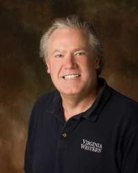 David Webb
Briefly describe your current faculty position and your typical teaching responsibilities.
Program head for GIS at VWCC where we have certificates and an associate degree program. Instruct the upper level GIS courses and manage our GIS adjunct faculty.
Briefly describe your expertise and experience in GIS and/or remote sensing.
Experience is in the teaching as indicated below. Have experience with instructional use of ArcGIS at the Arcinfo level for our four course technician level offerings. Developed two other 100 level courses for system wide use as survey and dual enrollment offerings.
Briefly describe your experience in teaching GIS or remote sensing.
Instructed courses in GIS for past six years, developed our GIS career pathway, faculty participant in iGETT and currently Co-PI on a NSF Grant-GETVCC to spread the use of Geospatial technology and instruction across the Virginia Community College System.
Why do you want to participate in this workshop, and what might you be able to contribute to other participants?
Experience with program development, created our GIS advisory committee, some knowledge of the Virginia DACUM for Geo-spatial Technicians and the results of our first summer workshop for Virginia Community College faculty.
_
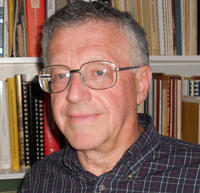 Peter Price
Briefly describe your current faculty position and your typical teaching responsibilities.
I am currently Adjunct Professor at CyFair College, Lonestar College System and a GIS Coordinator III for the same system. I teach various GIS and Geology courses and develop curricula and teaching resources. My main teaching responsibilities are advanced GIS and remote sensing courses. I am also a member of the GIS Advisory Committee for the System. I have consulted for other higher education organizations on GIS program development. I also consult for the resource industries in GIS applications.
Briefly describe your expertise and experience in GIS and/or remote sensing.
I am a Certified GISP. I have been head of the Remote Sensing group for Marathon Oil and Director of Geographic Information Systems for Burditt Associates and the Gulf Coast Institute. I have been recognized for my GIS service contributions to many non-profit and government organizations dealing with a variety of quality of life programs. I recently presented a paper at the Soc. of Historical Archeologists on GIS applications at the San Jacinto Battleground. I have a very diverse background in both GIS and remote sensing.
Briefly describe your experience in teaching GIS or remote sensing.
I have taught GIS and remote sensing for 11 years. I developed 8 GIS courses and was responsible for most of the GIS curriculum for the Lonestar College System. I have also taught many short courses and made numerous presentations for industry, educational organizations, and groups of all types.
Why do you want to participate in this workshop, and what might you be able to contribute to other participants?
I want to participate because of the critical importance establishing standards for skill and competence in this rapidly growing field. These standards are needed to align course offerings to workforce needs, to coordinate widely varying GIS programs, and to improve articulation among higher education entities.
My broad industry and higher education experience places me in a very favorable position to help address these issues. I have a track record of successfully sharing expertise and teaching resources.
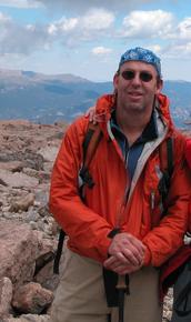 Phillip Yeager
Briefly describe your current faculty position and your typical teaching responsibilities.
Assoc. Prof in Biology. I currently teach a introductory GIS course using Prices text, and am deveoping two advanced courses using the ESRI turtorial series numbers II and III. I also teach Biology, Ecology, Entomology, Aquatic Ecology, and Environmental Science.
Briefly describe your expertise and experience in GIS and/or remote sensing.
Some use of GIS and remote sensing as a grad student.
Briefly describe your experience in teaching GIS or remote sensing.
Currently teaching Intro to GIS using Prices book. Use GIS in Ecology and Environmental Science courses. We are considering a Environmental Sceince proramd that would be built around GIS. Developing two advance courses using ESRI Turtorial texts II and III.
Why do you want to participate in this workshop, and what might you be able to contribute to other participants?
Interest in GIS education and defining the best way to present material and assess learning.

