San Diego Cohort Participants
This page displays the faculty participants who attended our second GTCM Development workshop in July 2011.
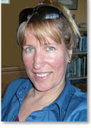 Deidre Sullivan
Briefly describe your current faculty position and your typical teaching responsibilities.
An administrative position with some teaching assignments including Introductory GIS.
Briefly describe your expertise and experience in GIS and/or remote sensing.
Spent 5 years as a marine geologist using GIS to make habitat maps. 10 years teaching experience teaching GIS A Masters in Geography and GIS. I work extensively with marine remotely sensed data.
Briefly describe your experience in teaching GIS or remote sensing.
I've taught GIS and marine remote sensing for 10 years.
 Eileen Goff
Briefly describe your current faculty position and your typical teaching responsibilities.
I am adjunct faculty in the GIS department at San Diego Mesa College, an introductory GIS class and a class on GIS databases. I teach two classes and oversee GIS course development and grant programs.
Briefly describe your expertise and experience in GIS and/or remote sensing.
I have extensive experience in GIS (since 1991) and limited experience with remote sensing.
Briefly describe your experience in teaching GIS or remote sensing.
I have taught a variety of GIS courses over approximately 9 years. This includes college courses at Mesa College, Esri-authorized training courses, workshops to adults and youth, and training sessions to co-workers and other organizations. I assisted in teaching one remote sening workshop but was not a primary instructor.
Why do you want to participate in this workshop, and what might you be able to contribute to other participants?
I played a major role in writing the GIS courses courrently taught at Mesa College and have a strong background in the objectives and goals for college-level GIS training. As someone who also works in GIS, I have a strong understanding of the types of skills needed for the workplace.
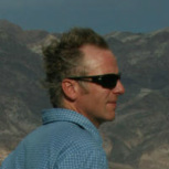 Hugh Howard
Briefly describe your current faculty position and your typical teaching responsibilities.
I am a tenured professor of GIS/Geography and GIS Coordinator. I teach the following GIS courses: Introduction, Cartographic Design, Spatial Analysis, Advanced, Work Experience. I am also responsible for maintaining our GIS program, including curriculum development, course scheduling, and hiring.
Briefly describe your expertise and experience in GIS and/or remote sensing.
My emphasis has been on education, but I have worked as a professional GIS analyst and cartographer in the fields of real estate, public health, and neighborhood food resources.
Briefly describe your experience in teaching GIS or remote sensing.
I have been teaching GIS for sixteen years. Schools include San Francisco State University (I ran and helped develop their GIS certificate program), City College of San Francisco (I taught their first GIS course), Stanford University, University of Oregon, and American River College. I have been a full-time professor at American River for six years.
Why do you want to participate in this workshop, and what might you be able to contribute to other participants?
I have participated in related activities, such as envisioning the GeoTech Center and the GIS Analyst DACUM held at American River College. We boast one of the largest and most successful GIS programs in the country, with 13 unique GIS courses, a certificate in GIS, and an A.S. degree in GIS.
 Michael Krimmer
Briefly describe your current faculty position and your typical teaching responsibilities.
Program Head, Geospatial Technology Program for Northern VA Community College (NOVA). Responsible for GST faculty recruitment, training, and mentoring--currently 7 adjunct faculty members and two teaching assistants. Oversee and guide curriculum and course development and conduct for 7 GST courses ranging from GIS Basics, through Cartography and Remote Sensing. Faculty advisor for GST students. Program Director for $495,000 DoL grant and $200,000 SBA grant--both of which are GST based. Developed, and oversee day to day operation of the Citrix GST-installation, which includes ArcGIS and ITT ENVI. Developed new GIS courses for the VA Community College System. Developed the NOVA GST Career Studies Certificate via a modified DACUM process. Pioneered teh GST articulation agreement, with guaranteed admission, between NOVA and James Madison University. Developing Associate of Science in GST for fall 2012 roll out. Plan and conduct GST education and training for regional high school faculty. Leading development of a GeoSpatial Leaders summer camp for at risk high school youth for summer 2011. Leading the transition of all GST coursework to ArcGIS10, ENVI4.8, and Clark University Labs Taiga. Represent community colleges on the USGIF academic advisory board. Member of advisory board for $700,000 NSF GTEVCC grant; workshop lecturer.
Briefly describe your expertise and experience in GIS and/or remote sensing.
Teach basic to advanced GIS courses: Basics of GIS, Intro to GIS, Intermediate GIS, 3D Analysis in GIS, GIS for Environmental Studies. Extensive use of imagery in GIS for Environmental Studies course, with reliance on the raster-based Clark University Labs Taiga GIS program. Experience with GIS in transportation applications and modeling with GIS--basis for doctoral research.
Briefly describe your experience in teaching GIS or remote sensing.
iGETT Cohort 2 member Developed Remote Sensing course for the Virginia Community College System. Continued development and refinement of the RS course; we are now moving towards two semester of RS, with the second semester addressing more advanced topics such as use of aerial imagery, photogrammetry, and so forth. Instructor for GIS courses, classroom and on-line at NOVA. Also teach graduate course, GIS for Civil Engineers, at George Mason University. Oversee an active GST internship program, with students placed with industry, government and non-profits. Major efforts with non-profit community groups to map trails and paths in Reston, VA, and to map historic water-powered mills (circa 1860) for the upper Shenandoah and the Potomac watersheds (a 6-state area). Will be a student presentation at 2011 ESRI User Conference.
Why do you want to participate in this workshop, and what might you be able to contribute to other participants?
Ideas and lessons learned in developing a GST pipeline. Steps to take and outlines to meet DOLETA guidelines, to include thoughts on working with WIBs, high schools, other colleges, and universities.
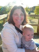 Angela Daniels
Briefly describe your current faculty position and your typical teaching responsibilities.
I teach all the GIS courses at Greenville Tech as a part of a 2-year Geomatics degree or a GIS Certificate. I teach introductory and advanced GIS courses including Cartography, GIS Analysis and GIS Databases.
Briefly describe your expertise and experience in GIS and/or remote sensing.
I am a geologist by schooling and have utilized GIS technology since 1991. I have a graduate certificate in GIS from UT Dallas. I worked as a GIS and Remote Sensing scientist from 1996-2006. I have worked in the environmental and DoD/Federal sectors as well as with water utilities. My remote sensing experience is with RADAR, multispectral and hyperspectral data analysis. I also have advanced terrain analysis skills and vector analysis skills.
Briefly describe your experience in teaching GIS or remote sensing.
I have taught GIS and Remote Sensing at the 2-year and 4-year level that spans 5+ years experience (3.5 years here at Greenville Tech and 2 years at University of West Georgia). I have redesigned almost all of the courses since beginning my tenure at Greenville Tech, updating the lectures and lab materials to include the newest technology and more advanced topics.
Why do you want to participate in this workshop, and what might you be able to contribute to other participants?
I would like to ensure that our curriculum meets the GTCM standards so that our program continues to produce high caliber graduates. I would also like the opportunity to contribute to the development of a model curriculum for GIS so that new faculty and new programs have a starting point and a reference point for their own courses. This will make it easier for transfer between colleges and for accrediting bodies to evaluate courses at different institutions.
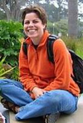 Karen "Allison" Lenkeit Meezan
Briefly describe your current faculty position and your typical teaching responsibilities.
Full time faculty in Geography and GIS. GIS program advisor. I teach (specific to GIS) Introduction to GIS, but am responsible for curriculum and student learning outcome data for all 36 units of GIS coursework offered at our college.
Briefly describe your expertise and experience in GIS and/or remote sensing.
I am a GISP. I have worked in GeoSpatial technology for over 15 years. I have worked as a GIS specialist for an Urban Planning company, as well as for an educational design group (SRI International). I have completed research work using GIS and RS with the USGS and Cambridge University.
Briefly describe your experience in teaching GIS or remote sensing.
I have taught GIS courses at the college level for 10 years and lead numerous professional development workshops for highschool and middle school teachers to bring GeoSpatial Technology into their classrooms.
Why do you want to participate in this workshop, and what might you be able to contribute to other participants?
I am very interested in contributing to the conversation about building model introductory GIS curriculum for CTE programs. In addition, I would like to see a model course articulated between community colleges and four year institutions. As a faculty at a California Community college I am in a strong position to advocate for articulation on the 2+2 model outlined in Title 5 of the California Education code.
 Jeff Cope
Briefly describe your current faculty position and your typical teaching responsibilities.
I am the program chair at Central Georgia Technical College for Drafting and GIS. I teach the software side of the Drafting Degree program and I teach all of the classes in the GIS degree Program.
Briefly describe your expertise and experience in GIS and/or remote sensing.
Used GIS in fire hydrant location and water line locations for work I completed for Monroe County. Used GIS for creating map related to educational project that the school and TCSG requested.
Briefly describe your experience in teaching GIS or remote sensing.
I have currently been teaching GIS for the last 2 1/2 years at the college. CGTC is one of 2 technical colleges in the state that offers a 2 yr degree in GIS. Currently working on dual enrollment program with local high schools to offer a technical certificate of credit that will transfer into the program here at CGTC.
Why do you want to participate in this workshop, and what might you be able to contribute to other participants?
I wish to gather information to help articulate high school curriculum into the college curriculum. Also I want to make sure that the college curriculum is current and up to date and meets the body of knowledge and matches up with other states college curriculum.
 Adam Dastrup
Briefly describe your current faculty position and your typical teaching responsibilities.
I am the Geoscience Coordinator at Salt Lake Community College (SLCC). As coordinator, I am responsible for curriculum, assessment, and scheduling for the Geography, Environmental Geology, Geomatics, and GIS programs. This summer I developed and had approved by the Board of Regents an interdisciplinary-focused GIS Certificate of Completion (more detail noted later). I have been full-time faculty for five years and have taught courses in meteorology, natural disasters, physical geography, human geography, regional geography, maps and measurements, introduction to remote sensing, and our beginning and advanced GIS courses. I am the chair of the college's Sustainability Committee and have integrated our geospatial technology courses within the newly created Sustainability Certificate SLCC now offers. This year the college asked if I would participate in the national Connect to Learning program, which is in partnership with AAC&U. The focus of C2L is on ePortfolios at an institutional and national level. Our GIS program now requires all students to develop a professional ePortfolio for their coursework as a way to show best work (more detail below).
Briefly describe your expertise and experience in GIS and/or remote sensing.
As coordinator for the Geoscience Department, I am responsible for the curriculum development and assessment of our GIS and remote sensing courses and program. I am an active member of the iGETT Cohort 2, where I ultimately created an extensive iGETT learning unit using ENVI and am now in the process of converting that to be used in ArcGIS 10. The work I did with iGETT lead to our first remote sensing course called Remote Sensing of Earth, which is now a physical science general education course.
This last summer, I successfully developed and had approved by the Board of Regents a GIS Certificate of Completion. The certificate is interdisciplinary in nature pulling students from a broad range of backgrounds, education levels, and academic interests. SLCC is interested in "stackable credentials", which are ways students can get an AS or AAS degree along with credit and non-credit certificates to make themselves more marketable in today's workforce. The program now has students from geography, environmental geology, geomatics, business, criminal justice, anthropology, ecology, sustainability, urban planning and architecture, and more seeking the certificate. We also have students with existing bachelor's and master's degrees coming back to seek the GIS Certificate of Completion. Since the certificate took place, student enrollment in the GIS program grew 300 percent in one academic year! Next year I am looking into creating a Geospatial Technology AAS degree, which will require all five of our GIS courses, remote sensing, photogrammetry, computer programing, and geography.
I have presented several times for iGETT in the last few years including twice for NCGE and once for ESRI's Education User Conference. I also did a national webinar on ePortfolios in GIS programs for the GeoTech Center in January and was asked by NCGE to do another webinar on the same topic later this year. This April I will be presenting at the AAG Conference on a panel discussion for the GeoTech Center and my focus will again be on ePortfolios in GIS programs.
Finally, I am very active in finding ways to integrate geospatial technology in the high schools. I am on the Utah GIS Education Committee, which is looking at ways to create a teaching endorsement for educators in geospatial technology along with having a concurrent enrollment course in geospatial technology taught in the Salt Lake Valley. I will also be in Washington D.C. this April to be an active member of the proposed HiGETT project being developed by Jeanne Allen from NASA's Goddard Space Flight. The focus of the workshop is to look at ways to incorporate geospatial technology, specifically remote sensing with GIS, into high school curriculum.
Briefly describe your experience in teaching GIS or remote sensing.
I have taught geospatial technology courses at SLCC for five years, which includes our introductory and advanced GIS courses, the Maps & Measurements course, and now the introductory remote sensing course. As coordinator of the program, I have developed all of the curriculum outcomes and assessment plans for all of the GIS and remote sensing courses. All of our courses are based on inquiry and hands-on learning with a focus on application of the ArcGIS software. The remote sensing courses is based on the learning units developed through the iGETT program using ITT ENVI. My professional goal as coordinator of my program is to now align our courses and GIS program to the GTCM and that is why I am very interested in participating in this workshop.
Every GIS and remote sensing course offered at SLCC requires their work being placed in a student ePortfolio as a way to showcase best work. Ultimately students going through the GIS program will have a professional ePortfolio they can use for 4-year school enrollment, applying for graduate school, or for workforce development.
Why do you want to participate in this workshop, and what might you be able to contribute to other participants?
As just mentioned above, I have been very active in professional development for our students by participating in workshops and programs such as iGETT, HiGETT, and ePortfolios in GIS programs. As coordinator of the Geoscience Department, I am responsible for the development of learning outcomes and assessments for a program that grew 300 percent following the creation of our GIS Certificate of Completion. When I created the certificate, I based the learning outcomes and assessment on the GIS&T Body of Knowledge. From my understanding, the GTCM is an extension on the Body of Knowledge and is something I now want to base my GIS program now on. I am a strong believer that the geospatial profession needs a strong national standard that academic programs like community college's can follow to make sure we are meeting local, state, and national demands, needs, and trends.
I believe it is also important to note that SLCC is one of the largest community college's in the nation with over 60,000 students and is the largest institution of higher learning in the State of Utah. The Census 2010 noted that the hispanic population grew over 70 percent in Utah over the last decade and the college is finding itself to not only be one the largest, but becoming highly diverse in it's student population.
 Robert Welch
Briefly describe your current faculty position and your typical teaching responsibilities.
I'm a Professor at Lansing Community College for the past 34 years. I started the first two year degree program in GIS technologies in 1984, and worked with various grants to build labs and develop curriculum.I have given hundreds of presentations nationwide. I currently teach ecology related courses involving GIS.
Briefly describe your expertise and experience in GIS and/or remote sensing.
Most in curriculum development and labs.
Briefly describe your experience in teaching GIS or remote sensing.
Teaching intro class and developing labs for other courses.
Why do you want to participate in this workshop, and what might you be able to contribute to other participants?
Yes I would and have been at it for quite some time and could share the good and not so good in developing programs.
 Les Doak
Briefly describe your current faculty position and your typical teaching responsibilities.
Professor, and Co-Chair, Department of Geography. Have taught GIS and GPS since their early develpoments beginning 1992. Teach full range of Earth Science, Earth Technologies, and Human Studies in Geography, utilizing GIS/GPS where applicable.
Briefly describe your expertise and experience in GIS and/or remote sensing.
Created California State Chancellor approved GIS Certificate in 1998. Taught GIS/GPS. Created GIS/Marketing Certificate. Created Industry Advisory Committee for GIS Certificate program. Awarded NSF, DOT, DOE, and several State of California grants to study and apply active learning pedagogy to technical training, specifially GIS. Worked with NCGIA, University of Texas and UCAR on NSF grants having to do primarily with applications of advanced technology, particularly GIS. Presented research papers to state, regional, national and international conferences regarding GIS and new pedagogical approaches.
Briefly describe your experience in teaching GIS or remote sensing.
As above. Created California State Chancellor approved GIS Certificate in 1998. Taught GIS/GPS. Created GIS/Marketing Certificate. Awarded NSF, DOT, DOE, and several State of California grants to study and apply active learning pedagogy to technical training, specifially GIS. Worked with NCGIA, University of Texas and UCAR on NSF grants having to do primarily with applications of advanced technology, particularly GIS. Presented research papers to state, regional, national and international conferences regarding GIS and new pedagogical approaches.
Why do you want to participate in this workshop, and what might you be able to contribute to other participants?
I am vitally interested in helping create a standard which is acceptable to industry and allows students to take the initiative in creativity, problem solving, and team work in these applications.
Miscellaneous
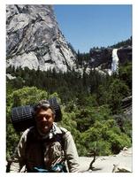
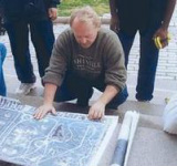
GIS has been a bright spot in student learning and understanding of geographic concepts for me since 1990. I began to develop and teach an introductory GIS course, experimenting with different pedagogical approaches. I discovered that when students selected their own projects, continued them over a four course sequence, conducted their own research, and presented their research to other students, they had the best opportunity to acquire a highly sophisticated skill and understanding level in GIS. They were required to work in teams, and consult each other for solutions before they consulted the instructor. They remained excited, overcame whatever barriers and developed creative work-arounds when needed. In fact, you couldn’t stop them. From the picture I provided, you can correctly assume that we were able to acquire field equipment, GPS/GIS, allowing us to take backpacking and vehicle field trips. (You will notice I was not the one having to carry the equipment.) GIS allows unparalleled research and exploration possibilities for individual students, as well as their class mates. In my opinion, no other technology allows such depth and sophistication in learning. I look forward to working with all of you in continuing to develop this wonderful opportunity for students.
 Daniel Waktola
Briefly describe your current faculty position and your typical teaching responsibilities.
I'm adjunct professor at East Los Angeles College (ELAC), responsible for teaching GIS course, and also engaged in the curriculum development of Certificate Program in GIS at ELAC.
Briefly describe your expertise and experience in GIS and/or remote sensing.
I'm a PhD holder and it is in the field of Remote Sensing and GIS (graduated in 2003). I have participated in several GIS RS based projects. Results of my research are published in several reputable journals, including two articles on the International Journal of Remote Sensing.
Briefly describe your experience in teaching GIS or remote sensing.
Since 2003, I have been teaching various courses of GIS and Remote Sensing at post graduate, undergraduate and college levels. At East Los Angeles College alone, I'm the first person to introduce GIS course, and attempting to fuse remote sensing applications in to the preexisting Physical Geography Laboratory course. In Fall 2011, I will be teaching Cartography and Base Map Development (3), Spatial Analysis and Modeling (3), and Introduction to Global Positioning Systems (GPS).
Why do you want to participate in this workshop, and what might you be able to contribute to other participants?
As I'm currently involved in the curriculum development of GIS Certificate Program in the East Los Angeles College, I will gain lots of information from the workshop, and enrich the quality of the output. In the mean time, I would contribute my experience and knowledge pertaining to the challenges and opportunities of teaching GIS and Remote Sensing to other participants.
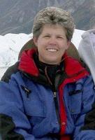 Debbie Crowley
Briefly describe your current faculty position and your typical teaching responsibilities.
I am a part time instructor at both Santa Ana College and Coastline College, I have taught GIS classes at both schools. I developed the courses with assistance from the department chair. I've also created and taught a few GIS Webinars and seminars for the Orange County Department of Education.
Briefly describe your expertise and experience in GIS and/or remote sensing.
I have no remote sensing experience. My GIS experience is minimal. I've done a few small projects for clients.
Briefly describe your experience in teaching GIS or remote sensing.
I've been teaching "Introduction to GIS" for approximately 5 years at Santa Ana College.
Why do you want to participate in this workshop, and what might you be able to contribute to other participants?
I have been asked by Santa Ana College to develop some new GIS courses. I figured that this workshop would help me to create better classes that meet the workforce needs. I would do my best to make constructive observations of my colleagues' work and look forward to there assistance with mine.
 Dario Rodriguez-Bejarano
Briefly describe your current faculty position and your typical teaching responsibilities.
RGIS Program Assistant and Instructor at the Geospatial Information Technologies (GIT) Program of the two-year college Southwestern Indian Polytechnic Institute (SIPI).
I teach or co-teach GIS/Remote Sensing courses each trimester and possibly two courses during a summer program we offer every year. I also direct applied GIT projects students on our GIT Program undertake either for degree credit or for student work.
Briefly describe your expertise and experience in GIS and/or remote sensing.
I hold degrees in Forest Photo-interpreation, Tropical Forest Management, and Remote sensing. I have worked both as a consultant on GIS/GIT/Remote Sensing or have taught at several institutions in the USA and abroad.
Briefly describe your experience in teaching GIS or remote sensing.
I have taught remote sensing and GIS courses at five higher degree institutions in Chile, Mexico and the USA.
Why do you want to participate in this workshop, and what might you be able to contribute to other participants?
Hope to get experiences from other participants dealing with Native American issues of natural resource management using GIS/GIT/Remote Sensing. I have over 30 years of experience in the field of natural resource management and mapping, which I hope to contribute.
 Kerry Lyste
Briefly describe your current faculty position and your typical teaching responsibilities.
Geography and GIS faculty and program advisor at Everett Community College. I teach: Physical Geography (with Geospatial labs); Cultural Geography; World Regional Geography; and Intro to Geography; as well as GIS 200 (Digital Cartography); GIS 201 (Intro to GIS); GIS 205 (Applications in GIS) GIS 250 (Internship in GIS) and GIS 299 (Independant Study in GIS).
Briefly describe your expertise and experience in GIS and/or remote sensing.
I have over 16 years in GIS (experience and CV is posted on my web page), and 4 years experience in Remote Sensing (iGETT Cohort 1 participant).
Briefly describe your experience in teaching GIS or remote sensing.
iGETT Cohort 1 participant; RS/GIS/GPS labs for Physical Geography; GIS 200; GIS 201; GIS 205; GIS 250; and GIS 299 (I have taught GIS at Everett Community College for over 10 years (since 2000).
Why do you want to participate in this workshop, and what might you be able to contribute to other participants?
I have a rich experience in GIS projects (including Tribal Applications) as well as having taught GIS for a reasonable period of time. In reference to what I would contribute to other participants, I enjoy building relationships and learning from other program successes as well as sharing what I have learned to be successful.
 Cindy Nance
Briefly describe your experience in teaching GIS or remote sensing.
1999 - 2000 taught two courses at Riverside Community College, CA (Introduction to GIS; Intermediate GIS) 1999-2009 taught two courses at University of California Riverside Extension (Spatial Analysis; GIS and Archaeology) 2000-present taught 5 courses at Mt. San Jacinto College, as part of degree and certificate in GIS (Introduction to GIS; Introduction to Cartography; Intermediate GIS; Advanced GIS Applications; GIS Science, Business and Government) - for which the early curriculum and course outline followed Ann Johnson's course outlines prepared for San Bernardino Valley College and has been rigorously modified every two years since.
Why do you want to participate in this workshop, and what might you be able to contribute to other participants?
I am interested in working on geospatial competencies per the model and tables recently published by URISA (September 2010).
I have a keen interest in fine tuning student learning outcomes, course objectives, and materials for teaching specific courses so that there are standards between curriculum. Currently, it seems every college has a different group of courses that they require for a bachelor's or masters. The course descriptions are often hybrids or discipline specific, and thus make it difficult for community college students to transfer or challenge that they have taken a similar course, i.e., an Introduction to GIS. Transfer is encouraged as a California state mandate (SB1440?) so that students do not waste time or money repeating courses.
Student Learning Outcomes are based on Course Objectives in Course Outlines, and are linked to the Department Learning Outcomes and Institutional Learning Outcomes and then are used to justify Program Review and college-wide articulation with the State Chancellor's Office. If everyone worked together on SLOs college wide, it would reduce the amount of redundant, repetititve and often inconsistent Student Learning Outcomes between institutions, especially the California Community College system.
I have extensive experience working with curriculum committee's that consist of College Vice Presidents, Deans, Staff and Faculty who know nothing about GIS and therefore often request changes that are inconsistent with the program's goals.
I have recently been introduced to Curricunet and can provide insight into submitting course outlines in an automated curriculum system.
1999 - 2000 taught two courses at Riverside Community College, CA (Introduction to GIS; Intermediate GIS) 1999-2009 taught two courses at University of California Riverside Extension (Spatial Analysis; GIS and Archaeology) 2000-present taught 5 courses at Mt. San Jacinto College, as part of degree and certificate in GIS (Introduction to GIS; Introduction to Cartography; Intermediate GIS; Advanced GIS Applications; GIS Science, Business and Government) - for which the early curriculum and course outline followed Ann Johnson's course outlines prepared for San Bernardino Valley College and has been rigorously modified every two years since.
Briefly describe your experience in teaching GIS or remote sensing.
1999 - 2000 taught two courses at Riverside Community College, CA (Introduction to GIS; Intermediate GIS) 1999-2009 taught two courses at University of California Riverside Extension (Spatial Analysis; GIS and Archaeology) 2000-present taught 5 courses at Mt. San Jacinto College, as part of degree and certificate in GIS (Introduction to GIS; Introduction to Cartography; Intermediate GIS; Advanced GIS Applications; GIS Science, Business and Government) - for which the early curriculum and course outline followed Ann Johnson's course outlines prepared for San Bernardino Valley College and has been rigorously modified every two years since.
Why do you want to participate in this workshop, and what might you be able to contribute to other participants?
I am interested in working on geospatial competencies per the model and tables recently published by URISA (September 2010).
I have a keen interest in fine tuning student learning outcomes, course objectives, and materials for teaching specific courses so that there are standards between curriculum. Currently, it seems every college has a different group of courses that they require for a bachelor's or masters. The course descriptions are often hybrids or discipline specific, and thus make it difficult for community college students to transfer or challenge that they have taken a similar course, i.e., an Introduction to GIS. Transfer is encouraged as a California state mandate (SB1440?) so that students do not waste time or money repeating courses.
Student Learning Outcomes are based on Course Objectives in Course Outlines, and are linked to the Department Learning Outcomes and Institutional Learning Outcomes and then are used to justify Program Review and college-wide articulation with the State Chancellor's Office. If everyone worked together on SLOs college wide, it would reduce the amount of redundant, repetititve and often inconsistent Student Learning Outcomes between institutions, especially the California Community College system.
I have extensive experience working with curriculum committee's that consist of College Vice Presidents, Deans, Staff and Faculty who know nothing about GIS and therefore often request changes that are inconsistent with the program's goals.
I have recently been introduced to Curricunet and can provide insight into submitting course outlines in an automated curriculum system.
 Scott Jeffrey
Briefly describe your current faculty position and your typical teaching responsibilities.
I am a Professor and Program Director for the Geospatial Applications Program at the Community College of Baltimore County. I direct the Geospatial program at a 3 campus (5 extension center) college which has 70,000 full and part-time students. Our current program enrollment contains 45 declared majors seeking either an Introduction to GIS certificate, Advanced GIS certificate, or A.A.S. degree in Geospatial Applications. We offer 5 geospatial classes of which, during any given seemester, I teach 3. My typical teaching load is to teach a section of Introduction to GIS, Intermediate GIS, and Remote Sensing. We also offer a Decision Making using GIS and Advanced GIS course.
I oversee 2 fulltime faculty and 7 adjunct faculty as well as coordinate the GIS in Business conference held her at the college. the GIS in Business conference brings 60-80 business onto campus for educational workshops and demonstations. This also provides a foundation for internship development.
Briefly describe your expertise and experience in GIS and/or remote sensing.
BS in Geography (UMBC, 1981) with research conducted in coastal geomorphology that integrated satellite imagery and analysis. MS in Geography and Anthropology at LSU (1985) in advanced coastal geomorphology which continued to incoroporate satellite image but also exposed me to side-scan sonar imagery. Self-taught in GIS and Applied remote Sensing techniques including the itegration of satellite imaging sooftware (ERDAS Imagine and ERDAS Image Analysis).
Briefly describe your experience in teaching GIS or remote sensing.
Developed the Geospatial Applications program at the Community College of baltimore County (CCBC). First program in the country to have 100/200 level courses articulate to transfer institutions as 300/400 level credit. Developed coursesw in Intro/Intermediate/and Remote Sensing along with lecture and lab materials.
Why do you want to participate in this workshop, and what might you be able to contribute to other participants?
I would like to participate in this workshop to see what other faculty members have created and how they envision the integration and development of, what would essentially be, a national model for introdctory GIS courses.
I bring to the table:
- experience in program development and direction
- expereince in curriculum development and coordination
- expereince in articulation design and implementation
- expereience in internship development

