Textbooks
Introduction to Geospatial Technologies
Designed for use in an introductory GIS, Digital Earth, or combined introductory GIS/remote sensing course, Introduction to Geospatial Technologies introduces the wide range of geographic information systems available to and used by geographers. Each chapter is divided into two sections:an introduction to the technology and a hands-on lab activity that utilizes free software widely available on the Internet or ArcGIS, depending on the instructor's preference. Because of its introductory approach and wide-ranging applicability, the book can be used effectively by both non-majors and majors.
Designed for use in an introductory GIS, Digital Earth, or combined introductory GIS/remote sensing course, Introduction to Geospatial Technologies introduces the wide range of geographic information systems available to and used by geographers. Each chapter is divided into two sections:an introduction to the technology and a hands-on lab activity that utilizes free software widely available on the Internet or ArcGIS, depending on the instructor's preference. Because of its introductory approach and wide-ranging applicability, the book can be used effectively by both non-majors and majors.

GPS for Land Surveyors, 3rd Edition
Since the last edition of this international bestseller, GPS has grown to become part of a larger international context, the Global Navigation Satellite System (GNSS). Both GPS and GNSS technologies are becoming ever more important in the everyday practice of survey and mappers. With GPS for Land Surveyors, Third Edition, a book written by a land surveyor, for land surveyors, you can stay in the know on the latest GPS techniques, technologies, codes, and signals.
Since the last edition of this international bestseller, GPS has grown to become part of a larger international context, the Global Navigation Satellite System (GNSS). Both GPS and GNSS technologies are becoming ever more important in the everyday practice of survey and mappers. With GPS for Land Surveyors, Third Edition, a book written by a land surveyor, for land surveyors, you can stay in the know on the latest GPS techniques, technologies, codes, and signals.

A Gentle Introduction to GIS
Geographic information system, or GIS, is a powerful technology that has been called "geography on steroids." This book contains what you need to know on mapping terminology and digital mapping, how to locate geographic features and analyze their patterns, and how to generate travel directions, customer locations lists, and much more with GIS.
Geographic information system, or GIS, is a powerful technology that has been called "geography on steroids." This book contains what you need to know on mapping terminology and digital mapping, how to locate geographic features and analyze their patterns, and how to generate travel directions, customer locations lists, and much more with GIS.
Learning Python, Fourth Edition
Google and YouTube use Python because it's highly adaptable, easy to maintain, and allows for rapid development. If you want to write high-quality, efficient code that's easily integrated with other languages and tools, this hands-on book will help you be productive with Python 3.0 quickly. Each chapter includes a unique Test Your Knowledge section with practical exercises and quizzes, so you can practice new skills and test your understanding as you go.
Google and YouTube use Python because it's highly adaptable, easy to maintain, and allows for rapid development. If you want to write high-quality, efficient code that's easily integrated with other languages and tools, this hands-on book will help you be productive with Python 3.0 quickly. Each chapter includes a unique Test Your Knowledge section with practical exercises and quizzes, so you can practice new skills and test your understanding as you go.
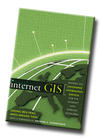
Internet GIS: Distributed Geographic Information Services for the Internet and Wireless Networks
Dr. Zhong-Ren Peng and Dr. Ming-Hsiang Tsou, is the first of its kind to thoroughly cover basic Internet GIS issues--such as the state of the art of technology and state of the practice of implementation, applications, and data, as well as the future trend of the Internet GIS--in preparation for using and getting the most out of newly available, off-the-shelf Internet GIS software packages.
Dr. Zhong-Ren Peng and Dr. Ming-Hsiang Tsou, is the first of its kind to thoroughly cover basic Internet GIS issues--such as the state of the art of technology and state of the practice of implementation, applications, and data, as well as the future trend of the Internet GIS--in preparation for using and getting the most out of newly available, off-the-shelf Internet GIS software packages.
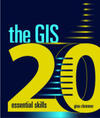
The GIS 20 Essential Skills
Geographic information system (GIS) is a powerful tool that can be challenging to navigate as a beginner, especially when you’re faced with a deadline. Inspired by a poll of 500 GIS practitioners, The GIS 20: Essential Skills is an easy-to-understand guide that emphasizes the top twenty skills most people need to master to be successful using GIS. A quick and comprehensive introduction to fundamental GIS skills, this book includes a data CD for completing the exercises. Written for professionals with no time for classroom training, The GIS 20 can be used for independent study, or an as-needed reference.
Geographic information system (GIS) is a powerful tool that can be challenging to navigate as a beginner, especially when you’re faced with a deadline. Inspired by a poll of 500 GIS practitioners, The GIS 20: Essential Skills is an easy-to-understand guide that emphasizes the top twenty skills most people need to master to be successful using GIS. A quick and comprehensive introduction to fundamental GIS skills, this book includes a data CD for completing the exercises. Written for professionals with no time for classroom training, The GIS 20 can be used for independent study, or an as-needed reference.
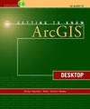
Getting to Know ArcGIS Desktop
Getting to Know ArcGIS Desktop introduces principles of GIS as it teaches the mechanics of using ESRI’s leading technology. Key concepts are combined with detailed illustrations and step-by-step exercises to acquaint readers with the building blocks of ArcGIS® Desktop including ArcMap for displaying and querying maps, ArcCatalog™ for organizing geographic data, and ModelBuilder™ for diagramming and processing solutions to complex spatial analysis problems. Its broad scope, simple style, and practical orientation make this book an ideal classroom text and an excellent resource for independent study. A data CD for working through the exercises is included with the book, and access to a 180-day trial of ArcGIS® Desktop 10 is provided.
Getting to Know ArcGIS Desktop introduces principles of GIS as it teaches the mechanics of using ESRI’s leading technology. Key concepts are combined with detailed illustrations and step-by-step exercises to acquaint readers with the building blocks of ArcGIS® Desktop including ArcMap for displaying and querying maps, ArcCatalog™ for organizing geographic data, and ModelBuilder™ for diagramming and processing solutions to complex spatial analysis problems. Its broad scope, simple style, and practical orientation make this book an ideal classroom text and an excellent resource for independent study. A data CD for working through the exercises is included with the book, and access to a 180-day trial of ArcGIS® Desktop 10 is provided.
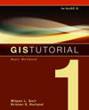
Getting to Know ArcGIS Desktop
Fourth Edition meets a growing demand for effective GIS training by providing tutorials and assignments that teach you how to collect data, create maps, and perform spatial analysis. Presented in a step-by-step format, the book can be adapted to your specific needs, whether these involve learning GIS in a classroom or using the book for independent study. Updated for ArcGIS 10, this workbook demonstrates a range of GIS functionality, from querying interactive maps to running geoprocessing tools, and it introduces ArcGIS extensions for advanced analysis. Reader-friendly exercises make GIS Tutorial 1 the perfect choice for beginners.
Fourth Edition meets a growing demand for effective GIS training by providing tutorials and assignments that teach you how to collect data, create maps, and perform spatial analysis. Presented in a step-by-step format, the book can be adapted to your specific needs, whether these involve learning GIS in a classroom or using the book for independent study. Updated for ArcGIS 10, this workbook demonstrates a range of GIS functionality, from querying interactive maps to running geoprocessing tools, and it introduces ArcGIS extensions for advanced analysis. Reader-friendly exercises make GIS Tutorial 1 the perfect choice for beginners.

Nature of Geographic Information
GIS&T is the intersection of professions, institutions, and technologies that produce geographic data and render information from it. It is a rapidly growing and evolving field. Learning is a way of life for all GIS&T professionals. With this in mind, I hope that this text may contribute to your lifelong exploration of how geospatial technologies can be used to improve the quality of life--yours and your neighbors', locally and globally, now and in the future.
GIS&T is the intersection of professions, institutions, and technologies that produce geographic data and render information from it. It is a rapidly growing and evolving field. Learning is a way of life for all GIS&T professionals. With this in mind, I hope that this text may contribute to your lifelong exploration of how geospatial technologies can be used to improve the quality of life--yours and your neighbors', locally and globally, now and in the future.

