
Archived Publications
The GeoTech Center produces a series of white-papers on our research efforts on a continuing basis.
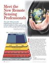
Meet the New Remote Sensing Professionals
Summary of GeoTech Center's research on competencies and job characteristics of "Remote Sensing Technicians". Includes results of an employment survey and a summary of 3 DACUM Job Analyses.
Summary of GeoTech Center's research on competencies and job characteristics of "Remote Sensing Technicians". Includes results of an employment survey and a summary of 3 DACUM Job Analyses.
GMCM GeoTech Evaluation
GeoTech Center's April 2012 evaluation of the proposed Geospatial Management Competency Model.
GeoTech Center's April 2012 evaluation of the proposed Geospatial Management Competency Model.

Inventory of Geospatial Workforce Competencies for GIS & Remote Sensing
Consolidation of 12 DACUM Job Analyses including 9 for GIS and 3 for Remote Sensing.
Consolidation of 12 DACUM Job Analyses including 9 for GIS and 3 for Remote Sensing.
Remote Sensing DACUM Meta-Job Analysis
Consolidation of 3 DACUM Job Analyses for Remote Sensing Specialists conducted in San Jose (2009), Milwaukee (2011) and Denver (2011).
Consolidation of 3 DACUM Job Analyses for Remote Sensing Specialists conducted in San Jose (2009), Milwaukee (2011) and Denver (2011).

DACUM Research Chart for GIS Specialist
March 27th & 28th, 2014
March 27th & 28th, 2014

DACUM Research Chart for Geospatial Analyst
October 22nd & 23rd, 2013
October 22nd & 23rd, 2013


GeoTech Center Quick Fact for New Programs
This one pager contains the most necessary resources for starting a new geospatial academic program.
This one pager contains the most necessary resources for starting a new geospatial academic program.
GIS / Geospatial Technician Workforce Competencies
Workforce tasks (Tier 7) and priority knowledge (Tier 6), skills and behaviors which are associated with the job of GIS/Geospatial Technician. These were identified by industry practioners through a national metaDACUM job analysis process which was conducted by the GeoTech Center in 2010.
Workforce tasks (Tier 7) and priority knowledge (Tier 6), skills and behaviors which are associated with the job of GIS/Geospatial Technician. These were identified by industry practioners through a national metaDACUM job analysis process which was conducted by the GeoTech Center in 2010.
What GIS Technicians Do: A Synthesis of DACUM Job Analyses - Supplemental Tables
Supplemental tables for the published article entitled "What GIS Technicians Do: A Synthesis of DACUM Job Analyses"; URISA Journal, Volume 22, Issue 2, 2010. Includes Table 3: DACUM Job Analyses for GIS Technician; Panel Information; Table 4: Tasks Performed by GIS Technicians Organized by Duty Categories; Table 5: Tasks Performed by GIS Technicians Grouped into Duty & Task Categories; Table 6: GIS Technician Knowledge, Skills & Worker Behaviors Grouped into Knowledge, Skills & Worker Behavior Categories
Supplemental tables for the published article entitled "What GIS Technicians Do: A Synthesis of DACUM Job Analyses"; URISA Journal, Volume 22, Issue 2, 2010. Includes Table 3: DACUM Job Analyses for GIS Technician; Panel Information; Table 4: Tasks Performed by GIS Technicians Organized by Duty Categories; Table 5: Tasks Performed by GIS Technicians Grouped into Duty & Task Categories; Table 6: GIS Technician Knowledge, Skills & Worker Behaviors Grouped into Knowledge, Skills & Worker Behavior Categories
What GIS Technicians Do: A Synthesis of DACUM Job Analyses
A consolidation of 8 DACUM Job Analyses for GIS Technicians from across the United States published in the URISA Journal Volume 22, Issue 2, 2010. Includes supplemental tables. Identifies 55 common task categories, 35 knowledge and skill categories and 27 behavior categories which are itemized, ranked and documented. This information can serve as the basis for new job descriptions, curriculum resources for education and training, criteria for inter-institutional program articulation, and requirements for professional certification.
A consolidation of 8 DACUM Job Analyses for GIS Technicians from across the United States published in the URISA Journal Volume 22, Issue 2, 2010. Includes supplemental tables. Identifies 55 common task categories, 35 knowledge and skill categories and 27 behavior categories which are itemized, ranked and documented. This information can serve as the basis for new job descriptions, curriculum resources for education and training, criteria for inter-institutional program articulation, and requirements for professional certification.

Free and Open Source Software for GIS education
The goal of this paper is to assist GIS educators at various institutes (high schools, community colleges and universities) towards understanding the potential role of open source software (or free and open source software -- FOSS) in GIS education.
The goal of this paper is to assist GIS educators at various institutes (high schools, community colleges and universities) towards understanding the potential role of open source software (or free and open source software -- FOSS) in GIS education.

Multidisciplinary Cooperation in GIS Education: A Case Study in US
In Journal of Geography in Higher Education (2010), 08 November 2010.
Title: Multidisciplinary Cooperation in GIS Education: A Case Study of US
Colleges and Universities.
Authors: Mizuki Kawabataa; Rajesh Bahadur Thapab; Takashi Oguchia; Ming-Hsiang Tsou.
In Journal of Geography in Higher Education (2010), 08 November 2010.
Title: Multidisciplinary Cooperation in GIS Education: A Case Study of US
Colleges and Universities.
Authors: Mizuki Kawabataa; Rajesh Bahadur Thapab; Takashi Oguchia; Ming-Hsiang Tsou.
Impact of the GTCM on Professional Surveyors
Article in Professional Surveying magazine by two of the DOL panelist who created the document.
Article in Professional Surveying magazine by two of the DOL panelist who created the document.

EDF Clean Energy Jobs Report for Texas
This report describes the Environmental Defense Fund Clean Energy Jobs for Texas.
This report describes the Environmental Defense Fund Clean Energy Jobs for Texas.

Web-based Editing of Geodata
Vince DiNoto provides us a technical explanation of using browser-based web-editing of geodatabases.
Vince DiNoto provides us a technical explanation of using browser-based web-editing of geodatabases.


ASPRS DACUM Description
Description of the ASPRS DACUM workshop planned for ASPRS Annual Conference in Milwaukee May 1-2, 2011, faciltated by John Johnson for Survey Technician SOC.
Description of the ASPRS DACUM workshop planned for ASPRS Annual Conference in Milwaukee May 1-2, 2011, faciltated by John Johnson for Survey Technician SOC.
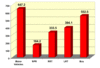
2010 Annual Survey Results in Graphic Format
The results of the 2010 national survey of two year geospatial educators is presented here in graphic format for a quick review of the findings (PDF).
The results of the 2010 national survey of two year geospatial educators is presented here in graphic format for a quick review of the findings (PDF).

2010 Annual National Survey of Geospatial Educators Results
The GeoTech Center produces an annual survey of the nation's 450 two year community and technical colleges in order to determine their most important issues in technology, curriculum, best practices, job market, etc. The URL here provides you direct access to the results.
The GeoTech Center produces an annual survey of the nation's 450 two year community and technical colleges in order to determine their most important issues in technology, curriculum, best practices, job market, etc. The URL here provides you direct access to the results.

2009 Annual National Survey of Geospatial Educators Results
The GeoTech Center produces an annual survey of the nation's 450 two year community and technical colleges in order to determine their most important issues in technology, curriculum, best practices, job market, etc. The URL here provides you direct access to the results.
The GeoTech Center produces an annual survey of the nation's 450 two year community and technical colleges in order to determine their most important issues in technology, curriculum, best practices, job market, etc. The URL here provides you direct access to the results.

Geospaitial Technology Competency Model (GTCM)
The new Geospatial Technology Competency Model, produced by the Department of Labor, with assistance from the GeoTech Center, provides a definitive and authoritative description of the industry, its sectors, and critical skills and knowledge of its workers.
The new Geospatial Technology Competency Model, produced by the Department of Labor, with assistance from the GeoTech Center, provides a definitive and authoritative description of the industry, its sectors, and critical skills and knowledge of its workers.

Remote Desktop Access
Getting students connected to GIS application software can be complicated and expensive. Many educators lack sufficient technology support to install and maintain a complicated GIS application. Using innovative technology, remote desktop access, allows students to access a powerful GIS server, located somewhere in the "Computing Cloud" right on their desktop.
Getting students connected to GIS application software can be complicated and expensive. Many educators lack sufficient technology support to install and maintain a complicated GIS application. Using innovative technology, remote desktop access, allows students to access a powerful GIS server, located somewhere in the "Computing Cloud" right on their desktop.

Recruitment Best Practices
Recruitment best practices are critical for the health of any academic program. Geospatial programs often need new ideas to help them attract and retain minority and under-served populations, like women and Hispanics.
Recruitment best practices are critical for the health of any academic program. Geospatial programs often need new ideas to help them attract and retain minority and under-served populations, like women and Hispanics.

Starting a New Program
This whitepaper describes how to create a new technology education program, step by step. It uses a Department of Labor methodology researched by several universities and community colleges.
This whitepaper describes how to create a new technology education program, step by step. It uses a Department of Labor methodology researched by several universities and community colleges.
