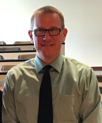
Assistant Director / Senior Team

Wing Cheung, Assistant Director / Senior Team, 760-744-1150 ext. 3652, [email protected]
Professor Wing Cheung is a Professor of Geography and Geographic Information Science at Palomar College. He is also the Coordinator of the GIS Certificate and Associate’s Degree programs at the College. Professor Cheung has experience in environmental science (groundwater and surface water hydrology), GIS, grant writing, project management, program development, and research. He has a diverse academic background with Master Degrees in Public Affairs and Environmental Science. Professor Cheung is the Principal Investigator of an Advanced Technological Education project grant from the National Science Foundation (DUE # 1003341), and an Assistant Director of the National GeoTech Center of Excellence funded by the National Science Foundation (DUE# 1304591). 
Chris Cruz, Assistant Director / Senior Team, 408-741-2622, [email protected]
Chris Cruz currently serves as the Department Chair for Park Management, Geospatial and Unmanned Aircraft Technology. He has taught at West Valley College in California for the last 21 years. Before that, he worked full-time for the National Park Service for 18 years and another 10 years seasonally as a Resource Protection Ranger, he has been fortunate to work in 12 national park units. Some of the positions he has held in the NPS, include SAR-EMS Officer for Yosemite NP, Law Enforcement Specialist and Operations Supervisor- Haleakala NP, Law Enforcement Specialist, Lake Roosevelt NRA, Backcountry Ranger Grand Canyon NP, Backcountry Ranger/Patrol- Lassen Volcanic NP, Patrol Ranger, Grand Tetons and Big Bend NP. He has a BA in Spanish Culture and Civilization from Indiana University and an MA in Environmental Studies from Prescott College, Az. He was a CO-PI on a National Science Foundation Project called iGETT Remote Sensing Education. Chris currently serving as a senior team member of the team for the National GeoTech Center with a focus on UAS Technology. He developed our Unmanned Aircraft Technology Program which was one of the first two approved such programs in California. He has FAA Part 107 Remote Pilot Certification. He also teaches for Drone University USA –UAS Drone First Responder Course and he maintains the GISP Certification. 
Adam Dastrup, Assistant Director / Senior Team, 801-957-4880, [email protected]
Adam Dastrup is the Coordinator of the Geosciences Department and an Associate Professor at Salt Lake Community College (SLCC). While there he has taught a variety of physical and cultural geography, earth and environmental science, and geospatial technology courses. He is also the founder of Open Geography Education, an open education resource (OER) for educators. At SLCC, Adam is a faculty leader in high impact practices, online learning, and educational pathways for students. Finally, Adam is heavily involved with advancing the teaching, learning, and application of geospatial technology in community college settings. 
Rodney Jackson, Assistant Director / Senior Team, 704-451-1720, [email protected]
Dr. Rodney Jackson serves as the Director for the Special Operations School of Information Technology (SOSIT) at the Joint Communication Unit. He also serves as a researcher for the National Geospatial Technology Center (NSF), as opportunities, present themselves. Rodney has 20 years of experience in higher education, having held various teaching and administrative positions at community colleges, universities, and institutions of higher learning. A geographer by training, he is Certified Geographic Information Systems Professional (GISP). Rodney retired from the United States Army Reserves as Lieutenant Colonel in the Engineer Corps (Geospatial Designator) in 2017. He prefers to fly-fish local freshwater streams during his free time 
Candiya Mann, External Evaluator, [email protected]
Candiya Mann serves as the GeoTech Center's external evaluator. She is a Senior Research Associate at the Social and Economic Sciences Research Center of Washington State University. She has served as an external evaluator of numerous NSF Centers and projects and a presenter for the EvaluATE Center at Western Michigan University. 
Thomas Mueller, Assistant Director / Senior Team, [email protected]
Dr. Thomas R. Mueller has taught at California University of Pennsylvania for over 14 years. He has taught a wide variety of courses including World Regional Geography, GIS, crime mapping, demographic analysis, and spatial models in public safety. His research agenda has grown dramatically throughout his career at California University of Pennsylvania. He applies spatial theory to the real world, particularly using Geographic Information Systems. His key to building a successful research agenda is to produce work through a variety of scholarly endeavors, including conference presentations, grants, technical reports, book reviews and publications in professional journals. He also has taught numerous GIS workshops for members of the local community, professors at Cal U and other campuses, and for the K-12 community. 
Ming-Hsiang Tsou, Assistant Director / Senior Team, [email protected]
Ming-Hsiang (Ming) Tsou (senior researcher) is a Professor in the Department of Geography, San Diego State University. His research interests are in Internet mapping and distributed GIS applications, mobile GIS and wireless communication, multimedia cartography and user interface design, and software agents with GRID computing technology. He serves as the major university advisor to the GeoTech Center on matters of articulation and recruitment of minority students. |
Central Office
Director Associate Directors / Co-Principal Investigator Assistant Directors / Senior Team National Visiting Committee Center's Partners Assistant DirectorsThe Assistant Directors work as either the lead or co-lead on activities of the GeoTech Center and are part of the overall team of the GeoTech Center. They assist the directors on emerging trends in geospatial information, science and technology.
|

