GeoTech Center
  • HOME
  • NEWS AND EVENTS
  • RESEARCH STUDIES
  • EDUCATION
  • PROFESSIONAL DEVELOPMENT
  • CENTER INFORMATION
  • CONTACT US

November 07th, 2022

11/7/2022

 
Picture
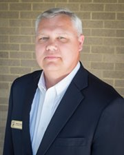
Rodney Jackson
The Geospatial Technology Competency Model (GTCM) has become an important resource for defining the geospatial industry and a valuable tool for educators creating programs since its finalization in 2010.  The GTCM defines the key knowledge and skills included within the domain of geospatial technology.  The University of Southern Mississippi’s Geospatial Workforce Development Center conducted an initial effort in the early 2000s to define skills and competencies.  This effort led to the first draft of the GTCM. This draft GTCM was reviewed by the Spatial Technologies Information Association with broad competency definitions.  Work continued under the direction of the Geographic Information Technology Association (GITA), the Association of American Geographers (AAG), and the Wharton School of Business at the University of Pennsylvania (DiBiase, et al., 2010, p.56)‡ but it remained a draft.  In early 2009 members of the National Geospatial Technology Center of Excellence (GeoTech Center) became involved in the effort to complete the GTCM.  A broad-based panel of geospatial experts was convened and suggested that shared industry-wide competencies become Tier 4, and industry-sector competencies become Tier 5.  Public comments were sought, and comments were addressed with a final GTCM draft submitted to the US Department of Labor’s Employment and Training Administration’s (DOLETA) Geospatial Technology Competency Model.  The draft was approved by DOLETA in 2010. The industry has continued to evolve and grow, and the GeoTech Center has undertaken the work to update the 2010 version of the GTCM.   Partnering with DOLETA, the GeoTech Center updated the GTCM in 2014 and 2018.  The USDOL prefers that competency models are updated every four (4) years. The document below is the 2022 update of the GTCM.  The GTCM update is focused on Tiers 1-5 as defined below:

Industry-Related Technical Competencies
  • Tier 5 -- Industry-Specific Technical Competencies 
  • Tier 4 -- Industry-Wide Technical Competencies
​
Foundational Competencies
  • Tier 3 -- Workplace Competencies 
  • Tier 2 -- Academic Competencies 
  • Tier 1 -- Personal Effectiveness 

​​‡ DiBiase, David, Corbin, Tripp, Fox, Thomas, Francica, Joe, Green, Kass, Jackson, Janet, Jeffress, Gary, Jones, Brian, Jones, Brent, Mennis, Jeremy, Schuckman, Karen, Smith, Cy, and Van Sickle, Jan. 2010. The new geospatial technology competency model: Bringing workforce needs into focus. URISA Journal 22(2): 55-72. December.

Information regarding prior work on the GTCM can be found in the documents provided below.
​
The New Geospatial Technology Competency Model - Bringing Workforce Needs into Focus
File Size: 18 kb
File Type: pdf
Download File

Geospatial Workforce Training And Development - Building Tomorrow's Workforce for Spatial Information Technologies
File Size: 355 kb
File Type: pdf
Download File


​The GeoTech Center is collaborating with the US Department of Labor to update the current GTCM. The first step in this process was to contact geospatial professionals through various organizations, agencies, etc., and solicit them to complete a review of the GTCM.  The evaluation, which consisted of a separate survey for each tier, asked about the relevancy of each competency to the current geospatial technology industry.  The results were summarized and evaluated by subject matter experts (representing different areas within the industry) through surveys and online discussions.  The results of this evaluation were brought to a workforce panel for evaluation and review in a workshop.  The proposed updates to the GTCM are now being released to the wider geospatial community for comment. Please evaluate the offered changes and comment, as needed.

​Tier 1: Personal Effectiveness Competencies

Tier 2: Academic Competencies

Tier 3: Workplace Competencies
 
Tier 4: Industry-Wide Technical Competencies

Tier 5: Industry-Sector Technical Competencies


Picture
         Comment
Wing Cheung
11/8/2022 11:21:59 am

My justifications are in the brackets [ ] following each proposed edit.

Tier 1:
Insert: Work and problem-solve in an organized and systematic manner [It is really meant to emphasize the importance of being organized and systematic in any situation, not only when dealing with GIS data]


Tier 2:
#45 “Speak clearly and confidently using common English conventions including proper grammar, tone, and pace” change to: Speak clearly and confidently using proper grammar, tone, and pace [We may have GIS professionals working across different cultural contexts and with different populations (e.g. indigenous communities) that do not speak English]

#76 “Code or script as needed”, and 77 “Develop web applications” seem to belong in a higher tier.


Insert: Geography- understand different ways in which locational information can be conveyed and shared (e.g. addresses, latitude, longitude). [This is not specifically going into datum, projection, or coordinate systems. But I think students should know what lat/long are before getting to a GIS class]


Tier 4:
#38 “Create mobile applications that leverage spatial data and location services” change to: Create web and mobile applications that leverage spatial data and location services

Insert: Awareness of the methods to enhance the accessibility of geographic information to individuals with disabilities.

Tier 5:
#9 “Know how spatial autocorrelation influences geospatial data and the choice of sampling strategies” change to: Know how spatial autocorrelation influences geospatial data and the choice of sampling strategies as well as analysis methods [particular tools or statistics, such as OLS, are not suitable for data where autorcorrelation is present]

#52 “Use scripting languages to automate repetitive geospatial analysis tasks” and #53 “Use scripting languages to automate repetitive tasks” seem redundant and can be merged.

Jerry Bartz
11/14/2022 12:45:57 pm

Tier 1:
Addition 3 Maintain and increase oral and written communication skills should be expanded to read:(Maintain and increase oral, written and multimedia communication skills.)

Tier 2
#14 Number Systems and Relationships - whole numbers, decimals, fractions, and percentages should be expanded to (Number Systems and Relationships - whole numbers, decimals, fractions,
percentages and significant figures).

#25 Physical Geography: Know and apply geographic information about the processes that shape physical landscapes; weather, climate and atmospheric processes; ecosystems and ecological processes; and natural hazards should be modified to read (Physical Geography: Know and apply geographic information about the processes that shape physical landscapes; weather, climate and atmospheric processes; ecosystems and ecological processes; and natural hazards -- throughout geologic time or perhaps historical time)

Addition 3
Familiarity with applications of extended realities.

Tier 4
#25 Acquire and integrate a variety of field data, image data, vector data, and attribute data to create, update, and maintain GIS databases. (Acquire and integrate a variety of field data, image data, vector data, attribute data and point clouds to create, update, and maintain GIS databases)

Area of concern. We are entering AI. There is no mention of Machine Learning, Neural Networks and Deep Learning.


Comments are closed.

    Author

    Rodney Jackson
    Assistant Directors / Co-Principal Investigator of the National Geospatial Center of Excellence.
    ​
    ​Dr. Rodney D. Jackson serves as the Director for the Special Operations School of Information Technology (SOSIT). He has 20 years of experience in higher education, having held various teaching and administrative positions at community colleges, universities, and governmental institutions of higher learning. A geographer by training, Rodney is Certified Geographic Information Systems Professional (GISP).  He prefers to fly-fish local freshwater streams during his free time. Rodney retired from the United States Army Reserves as Lieutenant Colonel in the Engineer Corps (Geospatial Designator) in 2017. 

Become a Member
Geospatial Resources
GeoTech Center's Presentations
Workshops
GTCM & Meta-DACUM Curriculum Guidelines
Map Library and Data
Veterans' Resources
Partners


Copyrighted ©2023  Jefferson Community and Technical College • 1000 Community College Dr. • Louisville, KY 40272 • (502) 213 - GEOT (4368) •JF-GeoTech@kctcs.edu 
​NSF: DUE 1304591, DUE 1644409
, DUE 1700496, DUE 1937177, DUE 1938717, DUE 1937237, and DUE 2202038
Opinions expressed are those of the authors and not necessarily those of the National Science Foundation. 
National Science Foundation